The Tongariro Alpine Crossing is a 20.2 km one-way alpine walk across an active volcanic area, taking 7 to 8 hours from November to April. Book the free DOC track booking, then a shuttle (from $75 return), because there is no summer visitor parking at the start. Check the forecast the night before and the 6 am Not Recommended Today advisory. From May to October it is a winter alpine route for people with skills and gear, or a guide.
On this page
Key facts
- Distance
- 20.2 km one way, Mangatepōpō to Ketetahi (DOC)
- Time
- 7 to 8 hours November to April, 9 hours May to October (DOC)
- Highest point
- Red Crater, 1,886 m (DOC)
- Track booking
- Free, recommended for everyone, required for shuttles and guides
- Shuttles
- From $75 return from National Park Village
- Not suitable for
- Children under 10 (DOC)
- Water
- Carry 2 to 3 litres, track water is not drinkable
- Checked
- As at November 2026
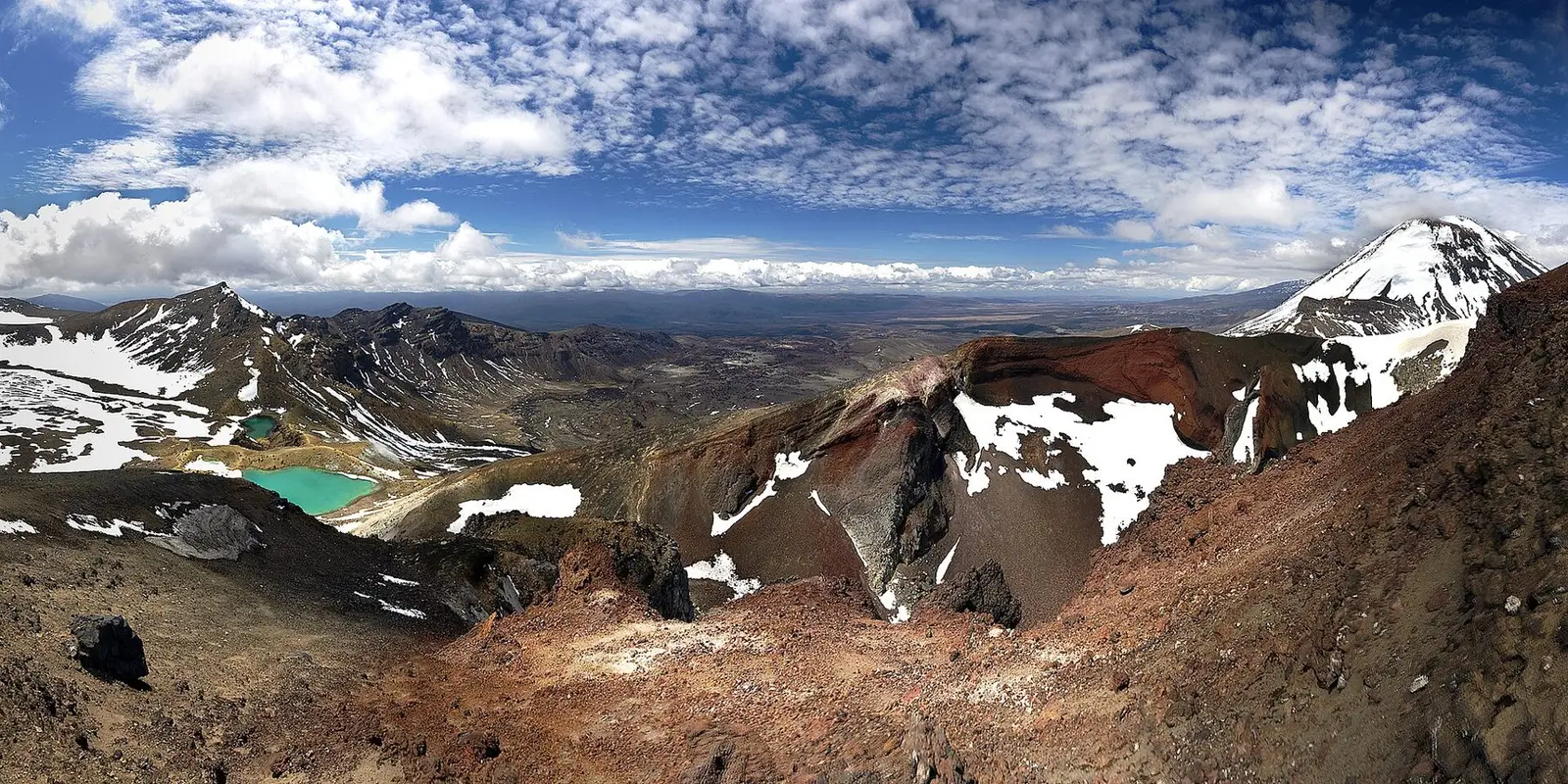
The Tongariro Alpine Crossing is often called the best one-day walk in New Zealand, and on a clear day it is hard to argue. In one long day you walk from a tussock valley up past the cone of Ngāuruhoe, across the steaming rim of Red Crater, down to the luminous Emerald Lakes and Blue Lake, then out through forest with Lake Taupō spread out below.
It is also an alpine route over an active volcanic area with weather that can turn on you in summer. Most of the trouble people get into comes from treating it like a park stroll. This guide covers what first-timers need to do it well and safely. Facts are from DOC unless stated, and prices are as at November 2026.
What the Crossing actually is
The track runs one way for 20.2 km from the Mangatepōpō road end (1,120 m) to the Ketetahi road end (760 m), through Tongariro National Park. DOC says to allow 7 to 8 hours from November to April and 9 hours from May to October.
Tongariro is New Zealand’s oldest national park. In 1887 Ngāti Tūwharetoa set aside the heart of the mountains, with the intent that the Crown would stand alongside them to protect it, and in 1993 Tongariro became the first place inscribed on the World Heritage List under the criteria for cultural landscapes (DOC). The mountains, lakes and waterways are sacred to Ngāti Hikairo ki Tongariro of Ngāti Tūwharetoa, who ask walkers not to touch or enter the lakes. Manaaki Rangers greet visitors daily from November to April.
Insider tip: In late 2025, two fires burned large areas near the start of the track. Ngāti Hikairo ki Tongariro have placed a 10-year restorative rāhui over the burnt area. Expect blackened slopes and new growth early in the walk, and stay on the track at all times.
The route, section by section
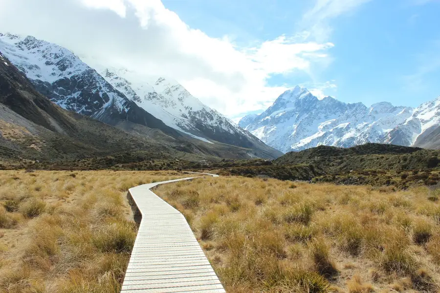
- Mangatepōpō Valley (gentle). A well-formed boardwalk climbs gradually up the valley. The first 5.4 km is shared with the Soda Springs Walk. The first toilets are only about 1 km (20 minutes) from the start, handy if there is a queue at the car park.
- The climb to South Crater (hard). At the end of the valley the track climbs about 350 m up a staircase to a short plateau in South Crater.
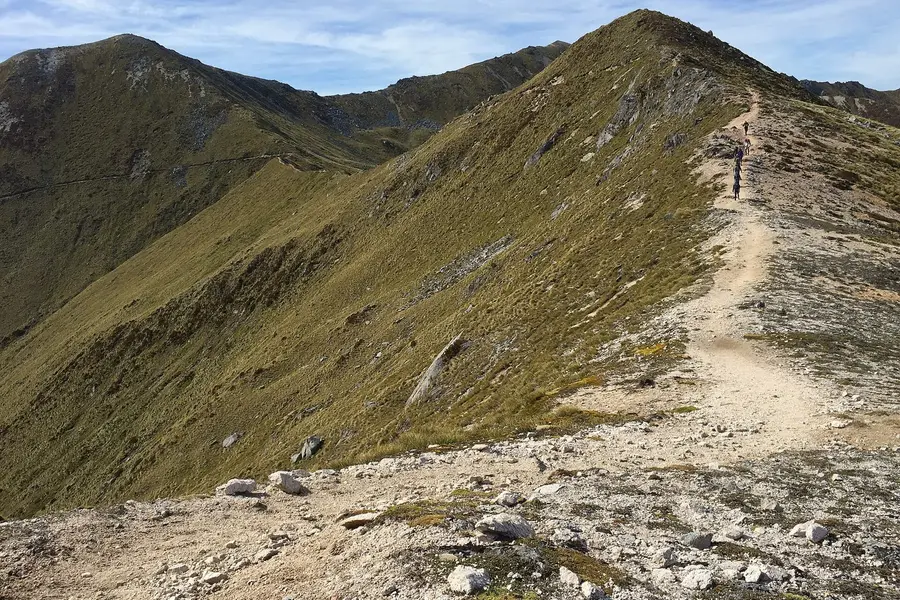
- Red Crater (hardest). Another climb takes you to the highest point of the Crossing at 1,886 m. This high, open section is exposed to the wind.
- Down to the Emerald Lakes (steep, loose). The descent is on volcanic scree. DOC warns that loose rocks on the steep slopes are a major slip hazard. Take your time and keep your weight over your feet.
- Blue Lake and the northern slopes (long). The track passes Blue Lake, Te Wai Whakaata o Te Rangihīroa, then starts the long zig-zag descent, with views over Lake Rotoaira and Lake Taupō. There are many steps, which DOC notes can be hard on weaker knees.
- Into the forest to Ketetahi (tired legs). The last stretch drops into bush and finishes at the Ketetahi road end.
The total change in elevation is about 1,196 m each way. Toilets are spaced every 1 to 2 hours, but there is no drinkable water anywhere on the track.
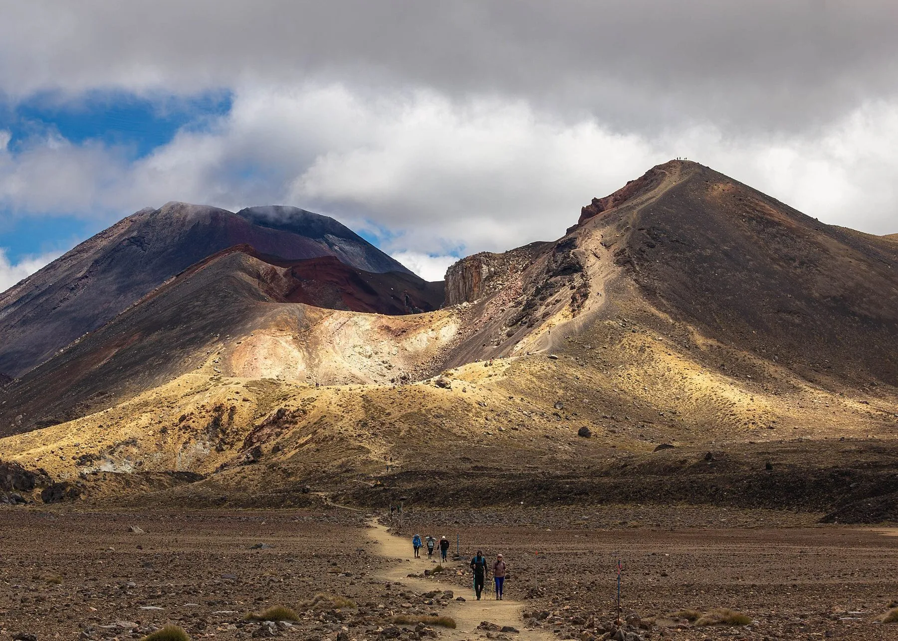 Walkers on the climb towards Red Crater. Photo: jokin.lacalle via Wikimedia Commons (CC BY 2.0).
Bookings, shuttles and parking
Step 1: the free DOC booking. DOC recommends a booking for everyone walking any part of the track, and you must have one to use a shuttle or guide. There is no cost and no cap on numbers. Book online, or ask any visitor centre or i-SITE. Save the confirmation email, because rangers may ask to see it at the car park. Walkers who arrive without a booking are not penalised.
Step 2: transport. The Crossing is one way, so you need to be dropped at one end and collected at the other. DOC says the best way to get there is by shuttle, and in summer there is no visitor parking for Crossing walkers at Mangatepōpō car park. There is a private car park near the Ketetahi end. DOC does not recommend parking on the side of state highways.
Two operators whose sites we checked:
- Tongariro Crossing Shuttles, based in National Park Village: return shuttle $75, with three departures a day. It also runs a one-way shuttle from a secure park and ride car park at Ketetahi to the start, so you walk back to your own car.
- Tongariro Expeditions, running Crossing transport since 1998: park and ride from $75, return from Taupō from $140, return from Tūrangi from $120. If unsafe weather means the crossing cannot be done, it offers to move your booking or refund it.
Book your shuttle and your DOC booking together, then check your pick-up time the night before.
Weather and the Not Recommended Today advisory
This is the most important section. DOC says it is common to get very cold temperatures, strong wind, heavy rain and poor visibility in summer, and that snow can fall at any time of year.
On a calm day, DOC says Red Crater is at least 10 °C colder than Taupō, and you should subtract another 2 °C for every 10 km/h of wind. So a pleasant 10 °C in Taupō can feel like −2 °C at Red Crater in a moderate 20 km/h wind.
Check two forecasts:
- The NIWA Tongariro forecast, which includes Red Crater. DOC uses this one for its advisory.
- The MetService Tongariro National Park mountain forecast, which also covers Red Crater and is a useful second opinion.
The advisory. During the summer season DOC assesses the NIWA Red Crater forecast at 6 am every day. It issues a Not Recommended Today advisory if, in any two hours between 9 am and 5 pm, the forecast shows any of: average wind of 55 km/h or more, gusts of 70 km/h or more, wind chill of −10 °C or colder, wind chill of 0 °C or colder with 1 mm or more of rain, rain of 2.5 mm an hour or more, or snow of 0.1 cm an hour or more. It also applies if 10 mm or more of rain is forecast over six hours in that window. When it applies, signs go up at the Mangatepōpō road end, an alert appears on the NIWA forecast, and shuttle and guiding operators are told by email.
From May to October there are no advisories, so you have to read the forecast yourself.
Volcanic and geothermal risk. Eruptions are unlikely but can happen at any time. Steam vents, especially near the Emerald Lakes, can cause severe burns, so stay on the marked track and do not touch or enter the lakes. Check the volcanic alert level on GeoNet before you go.
What to pack
DOC’s list for a summer day, on top of its standard day hike gear list:
- 2 to 3 litres of water per person
- Food, and toilet paper
- Waterproof jacket and waterproof pants
- Hat, gloves and warm layers: a merino or polypropylene base, fleece or wool, then a waterproof shell
- Sunscreen, because the volcanic landscape has almost no shade
- Sturdy boots with grip for the scree
- A charged phone, and ideally a personal locator beacon
No drones without a permit, and no mountain bikes.
Before you go, watch the NZ Mountain Safety Council walk-through video linked from the DOC track page. It covers the decision points, and when to turn back. If you are visiting from overseas, check your policy covers hiking and search and rescue costs; our travel insurance guide explains what to look for.
When to go, and when not to
November to April is the main season, with longer days, shuttles running and the advisory system in place. Start early so you are not racing the shuttle pick-up.
May to October is winter. DOC says the track is snow-covered and very icy in sections, and is for people who can navigate when markers are buried, recognise avalanche terrain, and use crampons, an ice axe, a helmet and avalanche rescue gear. Otherwise go with a guided trip, which DOC says includes transport.
Do not go if the advisory is up, if the forecast is marginal and you are inexperienced, or with children under 10. Be ready to turn back. Red Crater is a long way from the car on a bad day.
Easier alternatives
- Soda Springs Walk: the first part of the Crossing as an easy 2 hour return, with no shuttle logistics.
- Taranaki Falls and Tama Lakes are DOC’s suggested alternatives when conditions are poor. Ask at the visitor centre for times and conditions.
Where to base yourself
DOC lists the nearest towns with their distance from the track: Whakapapa (10.4 km), National Park (13.5 km), Tūrangi (36.7 km), Ohakune (48 km) and Taupō (86.5 km).
| Base | Drive to Mangatepōpō Road (estimate, no stops) | Why stay |
|---|---|---|
| National Park Village | About 20 minutes | Closest shuttle hub, early starts are easy |
| Tūrangi | About 35 minutes | Small town, return shuttles available |
| Taupō | About 1 hour 25 minutes | More food, accommodation and things to do |
Drive times are routing estimates without stops. If you have a rest day, Taupō is an easy add-on to our 10-day North Island road trip, and Rotorua is under two hours further north; see things to do in Rotorua.
Tongariro National Park Visitor Centre: Whakapapa Village, State Highway 48, phone +64 7 892 3729. Call in for current conditions before your walk.
FAQ
How hard is the Tongariro Alpine Crossing?
Do you need to book the Tongariro Alpine Crossing?
Can I park at the start of the Tongariro Crossing?
What happens if the weather is bad?
Can kids do the Tongariro Alpine Crossing?
Can you do the Crossing in winter?
Sources
Last checked 11 November 2026
- Tongariro Alpine Crossing · Department of Conservation
- Tongariro Alpine Crossing booking system · Department of Conservation
- Sustainable visitor management for Tongariro · Department of Conservation
- Tongariro National Park forecast (including Red Crater) · NIWA
- Tongariro National Park mountain forecast · MetService
- Tongariro Crossing shuttles · Tongariro Crossing Shuttles
- Tongariro Crossing shuttles and park and ride · Tongariro Expeditions
See more sources (1)See fewer
- Route distances and times (OpenStreetMap routing, no stops) · OSRM / OpenStreetMap contributors