For an easy big-mountain walk, do the Hooker Valley Track (10 km, 3 hours). For a hard climb with a famous view, Roys Peak (16 km, 5 to 6 hours, closed 1 October to 10 November). In the North Island, Rangitoto (7 km, 2 hours) is the easiest volcano summit and the Pouākai Crossing (19 km, 7.5 to 9.5 hours) the best Tongariro alternative. All times are DOC's, as at November 2026.
On this page
Key facts
- Easiest big view
- Hooker Valley Track, 10 km return, 3 hours
- Easiest North Island summit
- Rangitoto Summit Track, 7 km return, 2 hours (ferry access)
- Best Tongariro alternative
- Pouākai Crossing, 19 km one way, 7.5 to 9.5 hours
- Hardest on this list
- Avalanche Peak, 1,100 m climb in 2.5 km, advanced
- Seasonal closures
- Roys Peak 1 Oct to 10 Nov; Isthmus Peak 20 Nov to 20 Dec
- Cost
- All tracks are free to walk; some car parks charge (White Horse Hill $25 a day)
- Checked
- As at November 2026
The Tongariro Alpine Crossing gets the headlines, but it is one walk among hundreds of DOC tracks, many of them quieter, closer to where you are staying and no less beautiful. This list picks twelve day hikes across both islands, from a two-hour volcano stroll to a scramble up an 1,833 m peak.
Every distance, time and grade below comes from the Department of Conservation (DOC), as at November 2026. If you still want Tongariro, our Tongariro Alpine Crossing guide covers shuttles, parking and weather.
The shortlist
| Hike | Region | Distance | DOC time | DOC grade |
|---|---|---|---|---|
| Rangitoto Summit | Auckland | 7 km return | 2 hours | Easy to intermediate |
| Pinnacles (Kauaeranga Kauri Trail) | Coromandel | 6 km one way to hut, plus 1 km to summit | 6 to 7.5 hours return | Steps, ladders at the top |
| Te Whara Track | Northland | 7.5 km one way | 5 to 6 hours one way | Steep and undulating |
| Pouākai Crossing | Taranaki | 19 km one way | 7.5 to 9.5 hours | Advanced |
| Hooker Valley | Aoraki/Mount Cook | 10 km return | 3 hours | Gravel walking track |
| Roys Peak | Wānaka | 16 km return | 5 to 6 hours | Easy to intermediate |
| Isthmus Peak | Wānaka | 16 km return | 5 to 7 hours | Advanced |
| Rob Roy | Mount Aspiring | 10 km return | 3 to 4 hours | Easy to intermediate |
| Ben Lomond | Queenstown | 11 km return | 6 to 8 hours | Advanced |
| Key Summit | Fiordland | 3.4 km one way | 3 hours return | Intermediate |
| Lake Marian | Fiordland | 3.1 km one way | 1.5 hours one way | Advanced |
| St Arnaud Range | Nelson Lakes | 10 km return | 5 hours | Advanced |
| Avalanche Peak | Arthur’s Pass | 2.5 km one way, 1,100 m climb | 3 to 4 hours to summit | Advanced |
That is thirteen rows because Roys and Isthmus are a pair: when one is closed, use the other.
North Island hikes
Rangitoto Summit Track, Auckland. The easiest volcano summit in the country, and you start with a ferry ride. From Rangitoto Wharf the track climbs through lava fields and what DOC calls the world’s largest pōhutukawa forest to a lookout over Auckland and the Hauraki Gulf. It is 7 km return, about 2 hours. There is little shade, so go early on hot days, or take the Lava Caves Track, which is shadier and passes lava tunnels kids love. The island is pest free: check, clean and seal your bags before you board.
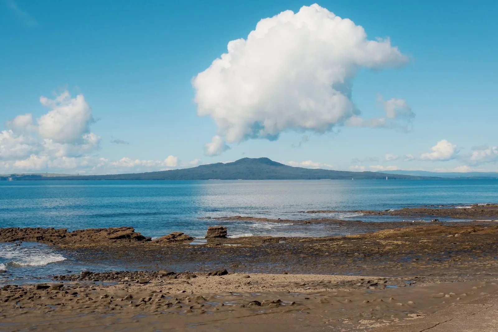 Rangitoto, the volcano you can see from half of Auckland. Photo: Roberto Machain via Pexels.
The Pinnacles, Coromandel. A classic. From the Kauaeranga Valley road end, near Thames, the Webb Creek Track climbs steps cut for packhorses in the kauri logging era to Pinnacles Hut (6 km, 2.5 to 3 hours). The final 1 km to the 759 m summit takes 40 minutes and includes ladders and steep drops. Allow 6 to 7.5 hours return, or 7 to 8.5 hours if you loop back on the Billygoat Track. The last 9 km of road is unsealed, and DOC warns that isolated car parks attract thieves.
Te Whara Track, Whangārei Heads. A one-way coastal ridge walk of 7.5 km and 5 to 6 hours from Ocean Beach to Urquharts Bay, past WWII radar station ruins to the Bream Head summit, with views to Cape Brett. It has many stairs, roots to scramble over and steep drop-offs, and it is not a loop, so arrange transport. Toilets are only at the two car parks and Peach Cove Hut.
Pouākai Crossing, Taranaki. The best like-for-like Tongariro alternative: 19 km one way, 7.5 to 9.5 hours, graded advanced. It runs from North Egmont past the Dieffenbach Cliffs, Holly Hut and the Pouākai tarns, where on a still day Taranaki Maunga reflects in the pools, down to Mangorei Road. DOC says walking in that direction means less climbing. Parking at North Egmont is limited until December 2026 while a new visitor centre is built, so DOC recommends carpooling or a shuttle.
South Island hikes
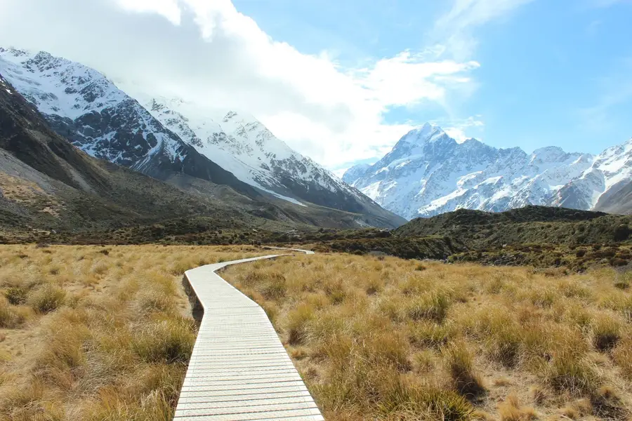
Hooker Valley Track, Aoraki/Mount Cook. The best effort-to-view ratio in the country: 10 km return, about 3 hours, mostly flat, over three swing bridges to an iceberg-dotted lake beneath Aoraki/Mount Cook. Parking at White Horse Hill costs $2.50 per half hour or $25 a day.
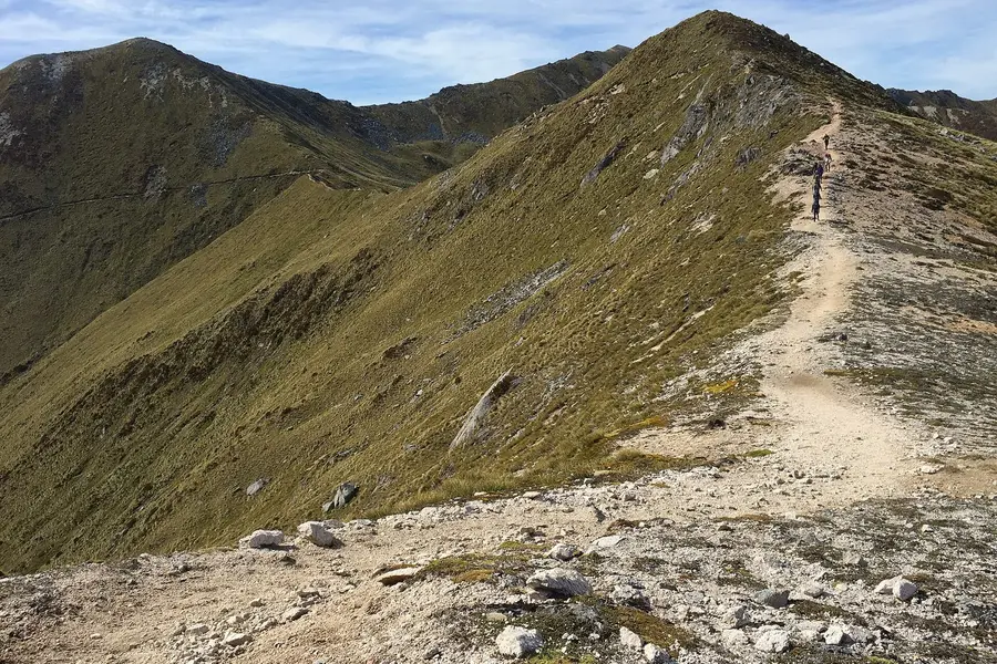
Roys Peak and Isthmus Peak, Wānaka. Roys is 16 km return and 5 to 6 hours, climbing over 1,200 m to a famous ridge above Lake Wānaka. It closes 1 October to 10 November for lambing. Isthmus Peak is the same length, steeper and quieter, with views of Lake Wānaka and Lake Hāwea, and closes 20 November to 20 December for fawning. Our things to do in Wānaka guide has more walks nearby.
Rob Roy Track, Mount Aspiring National Park. 10 km return, 3 to 4 hours to a hanging glacier, through a gorge and beech forest with kea about. The road in has gravel and fords that can flood. From May to November, DOC strongly recommends turning around at the lower lookout because of avalanche paths.
Ben Lomond, Queenstown. A big day: 11 km return, 6 to 8 hours, with 1,438 m of climbing from town to the 1,748 m summit. You can save the first climb by riding the Skyline Gondola and walking to Ben Lomond Saddle and back. In winter DOC says you need to carry and know how to use an ice axe, crampons and avalanche gear.
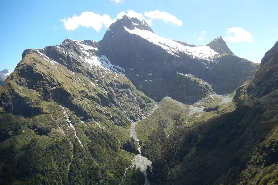
Key Summit and Lake Marian, Fiordland. Both are off the Milford Road. Key Summit is 3.4 km one way, about 3 hours return, starting on the Routeburn Track at The Divide and finishing with views over the Humboldt and Darran mountains. Lake Marian is 3.1 km one way, 1.5 hours each way, past waterfalls to an alpine lake, with a steep, muddy climb. Our Routeburn Track guide covers Key Summit in more detail.
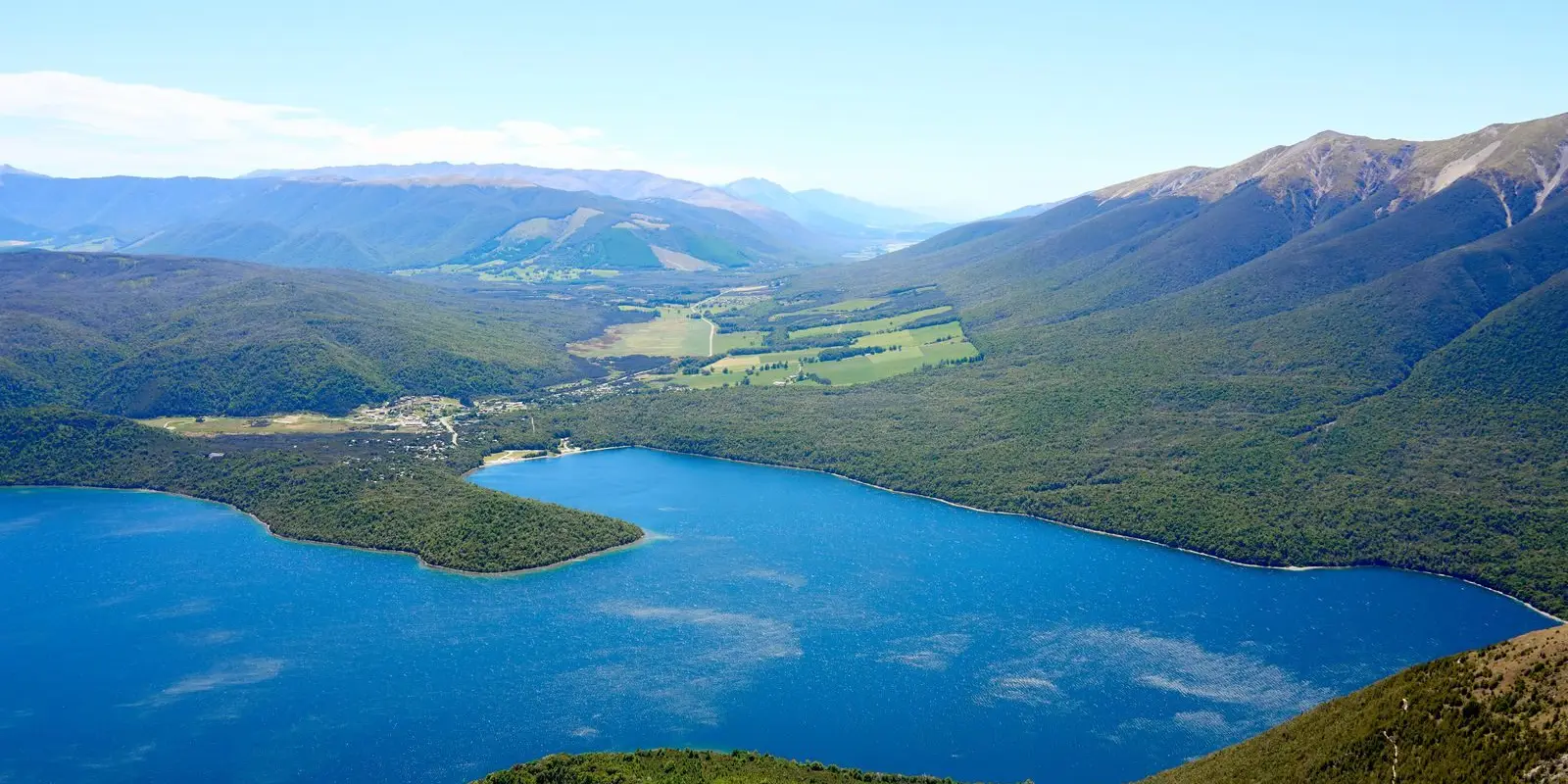
St Arnaud Range Track, Nelson Lakes. From Kerr Bay in St Arnaud, the track climbs through beech forest to the bushline at 1,400 m (about 2 hours) and Parachute Rocks, then on to over 1,650 m. 10 km return, 5 hours. In late spring and early summer the alpine herb fields flower gold and white. St Arnaud is 88 km from Nelson.
Avalanche Peak, Arthur’s Pass. The hardest here. A 1,100 m climb over just 2.5 km to an 1,833 m summit, 3 to 4 hours up. DOC is blunt: people have died on this route, and it should not be attempted in poor visibility or high wind. If you do the loop, DOC recommends going up the Avalanche Peak Track behind the visitor centre and down Scotts Track.
How to choose
Match the hike to your fitness, the weather and your route, roughly in that order.
| If you want… | Pick |
|---|---|
| Huge views with little climbing | Hooker Valley, Rangitoto |
| A long, social day out like Tongariro | Pouākai Crossing |
| A famous photo and a hard climb | Roys Peak (or Isthmus Peak) |
| Glaciers and waterfalls | Rob Roy, Lake Marian |
| A quick taste of Fiordland alpine | Key Summit |
| Something genuinely challenging | Avalanche Peak, Ben Lomond, St Arnaud Range |
| A coastal ridge | Te Whara Track |
DOC’s grades help. Walking tracks (easy and intermediate) are well formed. Tramping tracks are rougher and steeper. Advanced tramping tracks need good fitness and some backcountry experience, and routes like Avalanche Peak above the bushline are marked only with poles and cairns.
Insider tip: if a one-way hike like the Pouākai Crossing or Te Whara needs a car shuttle, ask the local DOC visitor centre or i-SITE for transport the day before. Then build your plan around the last pickup time, not your hoped-for walking pace.
Safety basics
DOC and the Mountain Safety Council boil outdoor safety down to five steps: choose the right trip, understand the weather, pack warm clothes and extra food, share your plans and carry a way to get help, and take care of each other.
On these particular hikes, the hazards are predictable:
- Alpine weather. Pouākai, Roys, Ben Lomond, Key Summit, St Arnaud and Avalanche Peak all go above the bushline, where conditions change fast. Turn back at DOC’s marked decision points if the weather turns.
- Avalanches. Several of these tracks cross avalanche terrain in winter and spring, including Rob Roy above the lower lookout, Isthmus Peak (usually May into November), Lake Marian and Avalanche Peak.
- Heat and no water. Roys and Isthmus have no water or shade. Rangitoto has little shade.
- Rivers and fords. The roads to Rob Roy and the stream before Holly Hut on the Pouākai Crossing can be impassable after heavy rain.
- Theft. DOC warns that isolated car parks, such as the Pinnacles road end, are targets. Leave nothing valuable in the car.
Walking on conservation land is free, but a rescue or a cancelled flight is not. Make sure your travel insurance covers hiking.
Gear for a big day
DOC’s gear list for Roys Peak works for any of these, with a few additions:
- Sturdy footwear with good grip
- A waterproof, windproof jacket and warm layers, even in summer
- Hat, sunscreen and sunglasses
- At least 1 to 2 litres of water per person, more for Roys or Isthmus
- Lunch and snacks
- A head torch, a charged phone and, for alpine tracks, a personal locator beacon
- In winter, microspikes or crampons and poles where DOC recommends them
Seasonal closures and timing
| Hike | Watch out for |
|---|---|
| Roys Peak | Closed 1 October to 10 November (lambing) |
| Isthmus Peak | Closed 20 November to 20 December (fawning) |
| Pouākai Crossing | Limited North Egmont parking until December 2026 |
| Rob Roy | Avalanche risk past the lower lookout, May to November |
| Avalanche Peak, Ben Lomond | Snow, ice and avalanche risk in winter and spring |
Summer (December to February) gives the longest daylight for the big alpine days, and outside winter you avoid most of the snow and ice warnings above. If you are walking in shoulder seasons, call the local DOC visitor centre for current conditions before you set off.
FAQ
What is the best day hike in New Zealand?
What is a good alternative to the Tongariro Alpine Crossing?
Do I need to book day hikes in New Zealand?
What does an advanced tramping track mean?
Can I do these hikes in winter?
Sources
Last checked 11 November 2026
- Rangitoto Summit Track · Department of Conservation
- Kauaeranga Kauri Trail (Pinnacles) · Department of Conservation
- Te Whara Track · Department of Conservation
- Pouākai Crossing · Department of Conservation
- Hooker Valley Track · Department of Conservation
- Roys Peak Track · Department of Conservation
- Isthmus Peak Track · Department of Conservation
See more sources (6)See fewer
- Rob Roy Track · Department of Conservation
- Ben Lomond Track · Department of Conservation
- Routeburn Track: Key Summit Track · Department of Conservation
- Lake Marian Track · Department of Conservation
- St Arnaud Range Track · Department of Conservation
- Avalanche Peak Route · Department of Conservation