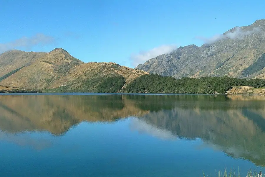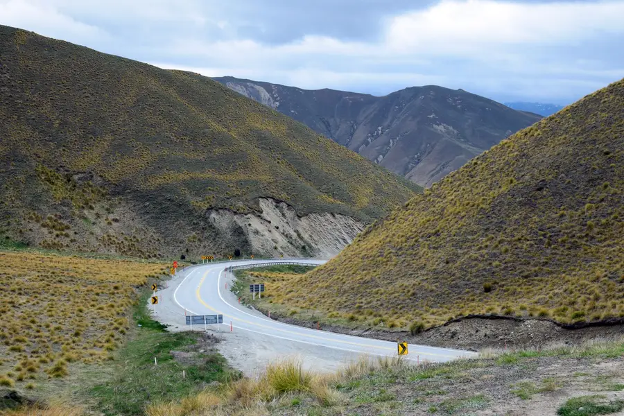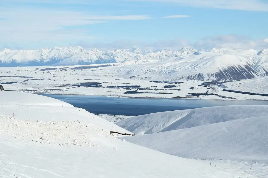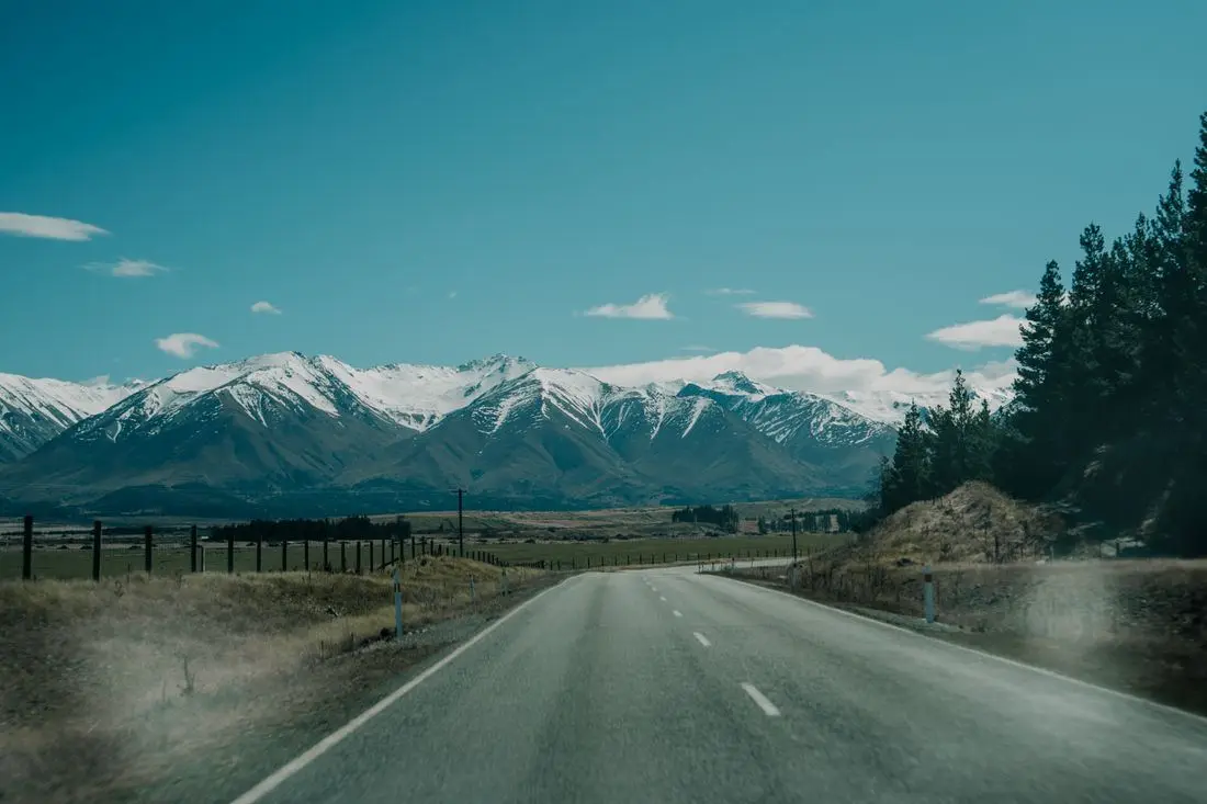
Loop clockwise from Christchurch: Arthur's Pass and the West Coast (Hokitika, Franz Josef), over the Haast Pass to Wānaka and Queenstown, down to Te Anau for Milford Sound, then back through Aoraki/Mount Cook and Lake Tekapo. It is about 2,000 km of driving with no day over five hours behind the wheel, plus a spare day for weather. Book early: your vehicle, any Milford Sound cruise, a glacier heli-hike if you want one, and accommodation in Queenstown, Te Anau, Aoraki/Mount Cook and Tekapo.
On this page
Key facts
- Start and finish
- Christchurch (loop)
- Total driving
- About 2,000 km
- Longest day
- Day 10, Te Anau to Twizel, about 360 km
- Must book early
- Vehicle, Milford cruise, heli-hike, Queenstown and Tekapo beds
- Fuel warning
- No fuel between Te Anau and Milford Sound
- Track closures to know
- Roys Peak closed 1 October to 10 November, Isthmus Peak 20 November to 20 December, every year
- Road alert
- Milford Road night closures Mon to Thu until 11 December 2026
- Checked
- As at November 2026
The South Island in two weeks is the classic New Zealand road trip for a reason. In fourteen days you can cross the Southern Alps twice, walk to a glacier valley, walk to the Blue Pools, cruise Milford Sound and fall asleep under one of the darkest skies on the planet. You will also spend a lot of time driving, so the route matters.
This is a loop from Christchurch that keeps every driving day under about five hours, front-loads the West Coast, and builds in a spare day for the weather (you will need it).
Route overview
- Start and finish
- Christchurch loop
- Days
- 14 days
- Total driving
- About 2,000 km
- Longest day
- Day 10, about 360 km
- Best time
- November to April
- Christchurch (day 1)
- Arthur's Pass (day 1)
- Hokitika (day 1)
- Franz Josef (day 2)
- Haast Pass (day 4)
- Wānaka (day 4)
- Queenstown (day 6)
- Te Anau (day 8)
- Milford Sound (day 9)
- Twizel (day 10)
- Aoraki/Mount Cook (day 11)
- Lake Tekapo (day 12)
- Christchurch (day 14)
Full route in Google Maps (opens in a new tab)
The days at a glance
- Day 1Christchurch to HokitikaAbout 250 km
- Day 2Hokitika to Franz Josef/WaiauAbout 200 km
- Day 3Franz Josef/Waiau to Fox Glacier/WehekaAbout 60 km return
- Day 4Franz Josef/Waiau to WānakaAbout 285 km
- Day 5WānakaMinimal
- Day 6Wānaka to QueenstownAbout 68 km
- Day 7Queenstown0 to 92 km
- Day 8Queenstown to Te AnauAbout 171 km
- Day 9Te Anau to Milford SoundAbout 238 km return
- Day 10Te Anau to TwizelAbout 360 km
- Day 11Twizel to Aoraki/Mount CookAbout 130 km return
- Day 12Twizel or Aoraki/Mount Cook to Lake TekapoAbout 58 km (104 km from Aoraki/Mount Cook)
- Day 13Lake Tekapo to ChristchurchAbout 225 km
- Day 14ChristchurchFree day
About 2,000 km in total. Driving times below are routing estimates without stops, based on OpenStreetMap data, unless we say they come from DOC. New Zealand roads are narrow, winding and full of photo stops, so add at least 20 to 30 per cent, and more in a campervan.
Day-by-day itinerary
Day 1: Christchurch to Hokitika via Arthur's Pass
Christchurch→Hokitikavia State Highway 73
- DistanceAbout 250 km
- Drive timeAbout 3.5 h
- OvernightHokitika
Cross the Southern Alps from the flat east coast to the wild west coast in one day, with limestone boulders, a big waterfall and a beach sunset along the way.
Today you cross the South Island from one coast to the other. Christchurch sits on the flat Canterbury Plains, and about 1.5 hours later (DOC) you are among the huge limestone boulders of Kura Tāwhiti/Castle Hill. Soon after that you enter Arthur's Pass National Park, set up in 1929 as New Zealand's third national park and the first in the South Island (DOC).
State Highway 73 is sealed, but it is a proper mountain road. It climbs to a 922 metre summit and drops down the Ōtira side through a zig-zag with five tight bends (Engineering New Zealand). Expect steep grades, single-lane bridges and weather that changes fast, even in summer. Snow can close the road, and DOC warns there is no mobile coverage in places.
The two sides of the pass feel like different countries: mountain beech forest on the drier Canterbury side, then dripping rainforest and red-flowering rātā on the West Coast side (DOC). You finish in Hokitika, a small beach town known for driftwood, sunsets and pounamu (New Zealand greenstone) carving.
How the day runs
- Morning8 am
Leave Christchurch with a full tank. Stop at Kura Tāwhiti/Castle Hill (about 1.5 h) and walk the loop among the boulders.
- Midday11.30 am
Arthur's Pass Village is about 50 minutes further on (DOC). Walk to Devils Punchbowl Falls, then grab lunch in the village.
- Afternoon2 pm
Cross the pass and wind down to the coast. Hokitika is about 1.5 hours from the village (DOC).
- Evening
Sunset on Hokitika beach by the driftwood sign, then the Glow Worm Dell once it is properly dark.
Stops and highlights5
Kura Tāwhiti/Castle Hill. Giant sculpted limestone rocks in tussock country. DOC protects the area for its rare plants, so eat only in the car park or at the picnic table and never mark the rocks.
- Time: 1.7 km loop, 40 min
- Cost: Free
- Parking: Free, but no overflow: never park on the highway
Devils Punchbowl Falls. A rough, steep track through mountain beech forest to a platform at the base of a 131 metre waterfall, with more than 400 steps. In full flow the spray soaks the platform.
- Time: About 1 h return
- Cost: Free
- Parking: Free, at the north end of the village
Bridal Veil Falls lookout. If your legs want more, the Arthur's Pass Walking Track reaches this lookout 20 minutes from the Punchbowl car park (DOC).
- Time: 20 min one way
- Cost: Free
Hokitika beach. Driftwood sculptures left from the Driftwood and Sand festival (held every January), the famous driftwood sign and big Tasman Sea sunsets (West Coast Tourism).
- Cost: Free
Hokitika Glow Worm Dell. A 50 metre track off State Highway 6 at the northern entrance to town leads to a bank of glow-worms, visible only after dark (Hokitika i-SITE).
- Time: 5 min return
- Cost: Free
- Parking: Right outside
Where to stay tonightHokitika
- Holiday park: Hokitika Holiday Park is listed by West Coast Tourism, the regional tourism organisation.
- Hotel: The Beachfront Hotel sits right on the beach in Hokitika (West Coast Tourism).
- DOC campsite: If you would rather stop in the mountains, Klondyke Corner is 8 km south of Arthur's Pass Village ($15 per adult a night). Avalanche Creek is in the village ($18) but sits between the road and the railway yards, so it is noisier. Both must be booked online, and no spaces are kept for walk-ins (DOC).
- Freedom camping: Only in a certified self-contained vehicle, and only where the council or DOC allows it. See our freedom camping guide.
Tip: DOC puts Christchurch to the Devils Punchbowl track at about 2.5 hours by car, so an early start leaves plenty of time for the walk.
Practical infoFuel, food, toilets, bookings, costs
- Fuel
- Fill up in Christchurch. Food and petrol options in Arthur's Pass Village are limited, with more services in Springfield before the pass and Hokitika after it (DOC).
- Food and coffee
- Springfield, Arthur's Pass Village (limited) and Hokitika. There is no drinking water on the Devils Punchbowl track, so carry your own.
- Toilets and dump stations
- At the Kura Tāwhiti car park and at the Arthur's Pass National Park Visitor Centre, 104 West Coast Road (DOC).
- Book ahead
- The DOC campsites at Arthur's Pass must be booked. In December and January, book Hokitika beds as soon as your dates are firm.
- Best time of day
- Leave early. The Castle Hill car park fills up, and you want to reach the coast with time for sunset.
- Phone coverage
- No coverage in places through Arthur's Pass (DOC). Download offline maps before you leave Christchurch.
- Watch out for
- Kea (cheeky alpine parrots) are protected: do not feed them. Thieves target cars at Arthur's Pass and Castle Hill car parks, so take your valuables with you (DOC). The Punchbowl track gets icy in winter.
- What today costs
- The walks and parking are free. Today's costs are fuel, food and your bed. DOC campsites on this road are $15 to $18 per adult.
Got extra time?
- Cave Stream: DOC suggests the Cave Stream Loop Walk, 5 minutes' drive from Kura Tāwhiti, if the Castle Hill car park is full.
- More of Arthur's Pass: the Arthur's Pass Walking Track is 6.8 km return (2 h 40 min) and links the Punchbowl, Bealey Chasm and Temple Basin car parks (DOC).
Skip if
Skip Devils Punchbowl if it is icy, snowing or you are running late. Kura Tāwhiti is the easier leg-stretch.
Day 2: Hokitika Gorge and on to Franz Josef
Hokitika→Franz Josef/Waiauvia State Highway 6
- DistanceAbout 200 km
- Drive timeAbout 2.75 h
- OvernightFranz Josef/Waiau
A turquoise river gorge in the morning, then south down the only road on the West Coast to the glacier country.
The West Coast is a long, thin strip of land squeezed between the Southern Alps and the Tasman Sea. About 80 per cent of it is conservation land (West Coast Tourism), and it is wet: DOC says Westland Tai Poutini National Park can get up to five metres of rain a year. That rain is why the forest is so lush and the rivers so blue on a dry day.
This morning you head inland through dairy farms to Hokitika Gorge (30 minutes by car, DOC), where the river runs milky turquoise over granite. Then it is south on State Highway 6 to Franz Josef/Waiau, a small glacier town on the edge of the national park, about 134 km away.
SH6 is sealed and mostly two lanes, with long gaps between settlements and plenty of one-lane bridges. Signs at each bridge show who has to give way.
How the day runs
- Morning8.30 am
Drive to Hokitika Gorge and walk the loop before the car park gets busy.
- Midday
Back in Hokitika for lunch and fuel, and a look at the pounamu carvers' studios.
- Afternoon2 pm
Head south on SH6 to Franz Josef/Waiau, about 2 hours with a stop or two.
- Evening
Settle in, check tomorrow's forecast and get an early night if you have booked a morning flight.
Stops and highlights2
Hokitika Gorge. A viewing platform (150 m from the car park), a swing bridge (300 m further) and an optional loop over the upper suspension bridge, which at 90 m is one of the longest in New Zealand (DOC).
- Time: 1.6 km loop, about 1 h
- Cost: Free
- Parking: Free; very busy November to April
Hokitika town. West Coast Tourism calls Hokitika the pounamu capital of the world. The Arahura River just north of town is considered the birthplace of pounamu, and you can watch carvers at work in town.
- Cost: Free to browse
Where to stay tonightFranz Josef/Waiau
- Campervan park: Franz Josef Campervan Park is in the centre of town, with showers, laundry and a kitchen (West Coast Tourism).
- Hotel: Heartland Hotel Glacier Country is in Franz Josef/Waiau (West Coast Tourism).
- Freedom camping: Self-contained vehicles only, where the council allows. See our freedom camping guide.
Do not swim in the gorge. DOC warns the river is swift, cold and dangerous, and people have drowned here.
Practical infoFuel, food, toilets, bookings, costs
- Fuel
- Fill up in Hokitika. Franz Josef/Waiau and Fox Glacier/Weheka both have service stations (DOC).
- Food and coffee
- Hokitika has the most choice. Franz Josef/Waiau has grocery stores (DOC) and places to eat.
- Toilets and dump stations
- Toilets and an accessible toilet at the Hokitika Gorge car park. No drinking water there (DOC).
- Book ahead
- Glacier heli-hikes and scenic flights for tomorrow, if you want one. Franz Josef beds in summer.
- Best time of day
- A dry, sunny morning. The river looks blue when it has not rained recently, and grey with glacial silt after heavy rain (DOC).
- Phone coverage
- No coverage beyond the gorge car park (DOC).
- Watch out for
- Sandflies (tiny biting flies) can be fierce at the gorge, so bring insect repellent. Kea and weka are protected: do not feed them. Do not swim.
- What today costs
- The gorge is free. Today's costs are fuel, food and your bed.
Got extra time?
- West Coast Treetop Walk: an elevated walk through the rainforest canopy near Lake Mahinapua, just south of Hokitika (West Coast Tourism).
- Ōkārito: a short detour off SH6 north of Franz Josef to kayak the Ōkārito Lagoon, with views of the Southern Alps (West Coast Tourism lists Okarito Kayaks).
Skip if
Skip the gorge after heavy rain, when the water turns grey. Spend a slow morning in Hokitika instead.
Day 3: Franz Josef and Fox Glacier
Franz Josef/Waiau→Fox Glacier/Weheka
- DistanceAbout 60 km return
- Drive timeAbout 1 h
- OvernightFranz Josef/Waiau
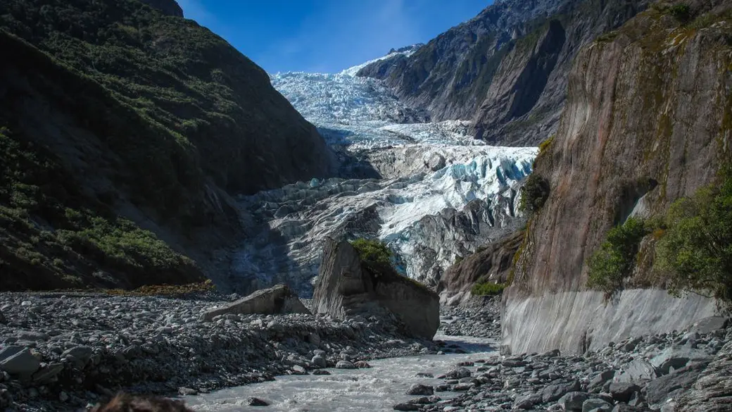
The Franz Josef Glacier valley. Photo: Francesco Ungaro via Pexels. A glacier valley walk or a helicopter onto the ice in the morning, and mirror reflections of Aoraki/Mount Cook at Lake Matheson in the evening.
Franz Josef Glacier/Kā Roimata o Hine Hukatere and Fox Glacier/Te Moeka o Tuawe flow down out of the Southern Alps almost to the rainforest. Both have retreated a long way, and the Franz Josef viewpoint is now around 3 km from the ice.
DOC says helicopters are the only safe way onto the glaciers for guided walks, so you will hear them all day. If standing on the ice matters to you, book a heli-hike. If not, the valley walk and Lake Matheson are free and still spectacular.
Driving today is short and local. The weather is everything here: low cloud can cancel flights and hide the peaks, so keep the plan loose and treat tomorrow morning as a backup.
How the day runs
- MorningFirst flight
Heli-hike or scenic flight if you have booked one. Otherwise walk the glacier valley before the crowds.
- Midday
Peters Pool, then lunch in town.
- Afternoon
The Tatare Tunnels walk from town, or a rest.
- EveningBefore sunset
Drive about 30 minutes south to Lake Matheson (DOC) for the reflections at dusk.
Stops and highlights4
Franz Josef Glacier walk. Follows the river valley to the viewpoint, about 4 km from town at the end of Glacier Access Road. Stay behind the barriers: river surges, rockfall and flash floods happen with little warning (DOC).
- Time: 1.7 km return, about 30 min
- Cost: Free
- Parking: $2.50 per half hour or $20 a day, card only; free under 10 min
Peters Pool. A short walk from the same car park to a small pool that reflects the glacier and the peaks (DOC).
- Time: 1.1 km return, 25 min
- Cost: Free
- Parking: Same glacier car park fees
Tatare Tunnels. An old tunnel walk starting at the end of Cowan Street in town. Bring a torch and a raincoat, and expect wet feet (ankle deep at worst) inside the tunnel (DOC).
- Time: 3.6 km return, 1 h 20 min
- Cost: Free
Lake Matheson/Te Ara Kairaumati. Famous for mirror reflections of Aoraki/Mount Cook and Mount Tasman in its dark water. The first section to Jetty Lookout suits wheelchairs (DOC).
- Time: Jetty Lookout 2.4 km return (45 min), full circuit 4.4 km (1 h 30 min)
- Cost: Free
- Parking: Free; busy November to April
Where to stay tonightFranz Josef/Waiau
- Same as last night: Stay a second night in Franz Josef/Waiau so you can use tomorrow morning if today's flight is cancelled.
- DOC campsite: Gillespies Beach Campsite is about 30 minutes by car from Lake Matheson (DOC).
Tip: Standing on the glacier itself means a helicopter. Heli-hikes and scenic flights only run when the weather allows, so book for this morning and keep tomorrow morning free as a backup.
Practical infoFuel, food, toilets, bookings, costs
- Fuel
- Franz Josef/Waiau and Fox Glacier/Weheka both have service stations (DOC). Fill up before tomorrow's long drive.
- Food and coffee
- Grocery stores in both glacier towns (DOC). Food and petrol are in Fox Glacier, 5 minutes from Lake Matheson (DOC).
- Toilets and dump stations
- Toilets and an accessible toilet at the Lake Matheson car park. No drinking water (DOC).
- Book ahead
- Heli-hikes and scenic flights: book ahead in summer, choose a morning slot and read the weather cancellation terms. DOC points to the daily glacier access update on the Glacier Country website.
- Best time of day
- Dawn or dusk on a fine, windless day for the best reflections at Lake Matheson (DOC).
- Phone coverage
- Unreliable at Lake Matheson (DOC).
- Watch out for
- Sandflies are everywhere here, so carry repellent. Heavy rain can arrive any time of year. Drones are not allowed.
- What today costs
- Glacier car park: up to $20 a day. Lake Matheson is free. A heli-hike or flight is the big spend if you choose one.
Got extra time?
- Big day walks: experienced hikers can tackle the Roberts Point or Alex Knob tracks for views over the glacier (West Coast Tourism).
- Ōkārito Lagoon: kayak it if you skipped it yesterday.
Skip if
Skip a heli-hike if the forecast is poor. Flights only go when the weather allows, and the free walks are still worth it.
Day 4: Franz Josef to Wānaka over the Haast Pass
Franz Josef/Waiau→Wānakavia Haast Pass
- DistanceAbout 285 km
- Drive timeAbout 4 h
- OvernightWānaka
One of the great drives in New Zealand: wild coast, rainforest waterfalls, the Blue Pools and two huge lakes, with long empty stretches in between.
Today you follow the coast south past lakes, rainforest and empty beaches to Haast, then turn inland and climb through Mount Aspiring National Park to Wānaka. The park was formed in 1964 and is part of Te Wāhipounamu South West New Zealand World Heritage Area (DOC).
Just before Haast Junction you cross the Haast River bridge, which a local lodge's route guide describes as the longest one-lane bridge in New Zealand. The Haast Pass itself is only 563 metres high, the lowest of the three road crossings of the Southern Alps, but the climb through the Gates of Haast is steep and winding.
This is the most remote stretch of the trip. Fuel stops are far apart and phone coverage comes and goes, so fill up, download offline maps and do not rush. On the eastern side the rainforest gives way to the big blue lakes Wānaka and Hāwea and dry golden hills.
How the day runs
- Morning8 am
Leave Franz Josef/Waiau. Fox Glacier/Weheka is 30 minutes south. Then follow the coast to Knights Point and Ship Creek.
- MiddayAround noon
Haast Junction: fill up at the petrol station and call into the DOC visitor centre next door.
- Afternoon
Up the Haast valley: Roaring Billy, Thunder Creek and Fantail Falls, over the pass, then the Blue Pools walk.
- Evening
Arrive in Wānaka and walk the lakefront.
Stops and highlights6
Knights Point. A prominent lookout with wide views along the coast (West Coast Tourism).
Ship Creek Tauparikākā. 20 km north of Haast. Two short walks from one car park: a boardwalk through ancient kahikatea swamp forest, and a trail to a dune lake and the beach. There is a viewing tower, toilets and picnic tables (DOC).
- Time: 800 m return (20 min) or 1 km loop (30 min)
- Cost: Free
Roaring Billy Falls. An easy fern-lined walk to a waterfall across the Haast River (DOC).
- Time: 1 km return, 25 min
- Cost: Free
Thunder Creek Falls. A sealed track to a platform facing a 28 metre waterfall, 50 km from Haast. The nearest toilets are at Pleasant Flat, 5 km back towards Haast (DOC).
- Time: 200 m return, 5 min
- Cost: Free
Fantail Falls. A short walk to a fan-shaped waterfall, 85 km from Wānaka (DOC).
- Time: 200 m return, 5 min
- Cost: Free
Blue Pools. Through silver beech forest to a swing bridge over the Makarora River and clear glacier-fed pools. The car park is 10 km north of Makarora (DOC).
- Time: 3.2 km return, 1 h 30 min
- Cost: Free
- Parking: Free; very busy November to April
Where to stay tonightWānaka
- Holiday park: Hampshire Holiday Parks Wānaka has cabins, powered sites and tent pitches a few minutes from the lakefront.
- DOC campsite: To break the drive, Cameron Flat is across the road from the Blue Pools car park ($15 per adult, booking required, DOC).
- In Haast: Haast River Motels and Holiday Park is listed by West Coast Tourism, if you need to stop early.
- Freedom camping: Self-contained vehicles only. Rules in and around Wānaka are tight, so check the council map. See our freedom camping guide.
Tip: The Blue Pools look best when it has not rained recently. If you arrive and the car park is full, Thunder Creek Falls is a quick fallback.
Practical infoFuel, food, toilets, bookings, costs
- Fuel
- Franz Josef or Fox Glacier, then Haast Junction (petrol station beside the DOC visitor centre), then Makarora, which has limited food and petrol (DOC). Treat Haast as the must-fill stop.
- Food and coffee
- Fox Glacier, then Haast township, 3 km south of the junction, which has a café, a tavern and a grocery store. Makarora has a café.
- Toilets and dump stations
- Ship Creek, the Haast visitor centre (open 9 am to 4.30 pm), Pleasant Flat and the Blue Pools car park (DOC).
- Book ahead
- Cameron Flat campsite if you want to stop. Wānaka beds in summer.
- Best time of day
- Leave early so you reach the Blue Pools before the car park fills. The pools are bluest when it has not rained for a while (DOC).
- Phone coverage
- Assume there is no coverage between towns, and download offline maps before you leave Fox Glacier.
- Watch out for
- Sandflies at Ship Creek, Roaring Billy and the Blue Pools. Heavy rain can cause slips, so check road conditions with NZTA and DOC before you set off.
- What today costs
- All the walks are free and the Blue Pools car park is free. Today's costs are fuel, food and your bed.
Got extra time?
- Jackson Bay: turn south at Haast Junction for 48 km of flat sealed road to a fishing village at the end of the road, with a fish and chips food truck called The Craypot (West Coast Tourism).
- Monro Beach: near Lake Moeraki, 30 km north of Haast. You might see tawaki (Fiordland crested penguins), most likely from August to November, early or late in the day (DOC, West Coast Tourism).
Skip if
Short on time? Skip Roaring Billy and Fantail Falls. Keep Thunder Creek Falls (5 minutes) and the Blue Pools.
Day 5: Wānaka
Wānaka
- DistanceMinimal
- OvernightWānaka
A day out of the car: a big ridge walk if you are fit, or the lakefront if you are not.
Wānaka sits at the southern end of Lake Wānaka, with Lake Hāwea next door and the Southern Alps behind (Lake Wānaka Tourism). It is smaller and calmer than Queenstown, and the right place to stop driving for a day.
The big outing is Roys Peak, the ridge behind all those famous lake photos. It is a long, steep, exposed climb with no shade or water, so it suits fit walkers on a clear day. If that is not you, the lakefront, a swim and the short tracks around town make an easy, lovely day.
How the day runs
- MorningEarly
Start Roys Peak early to avoid the heat and to get a car park.
- Afternoon
Back in town for lunch, then a lake swim or a stroll along the lakefront.
- Evening
Sunset on the lakefront.
Stops and highlights3
Roys Peak Track. A steady climb to a 1,578 metre summit above Lake Wānaka. The car park is about 6 km west of town on the Wānaka Mount Aspiring Road. Toilets at the car park and near the photo viewpoint, about 30 minutes below the summit (DOC).
- Time: 16 km return, 5 to 6 h
- Cost: Free
- Parking: Free, but often full; do not park on the road edge
Isthmus Peak Track. DOC's quieter alternative, 30 minutes' drive north of Wānaka beyond Lake Hāwea. Steep: you gain 1,000 metres in 8 km, with no water on the track.
- Time: 16 km return, 5 to 7 h
- Cost: Free
Wānaka lakefront. Walk, swim or sit. You can also walk or cycle the Waterfall Creek and Glendhu Bay tracks along the lake from town (DOC).
- Cost: Free
Where to stay tonightWānaka
- Holiday park: Hampshire Holiday Parks Wānaka, a stroll from Roys Bay and the lakefront.
- Motels and hotels: Plenty in town, but book early for December to February.
- Freedom camping: Self-contained vehicles only, and rules near town are tight. See our freedom camping guide.
Track closures: Roys Peak is closed every year from 1 October to 10 November for lambing, and Isthmus Peak from 20 November to 20 December for fawning (DOC).
Practical infoFuel, food, toilets, bookings, costs
- Fuel
- Wānaka has a 24/7 fuel stop on Ballantyne Road (Allied Petroleum) plus other stations.
- Food and coffee
- Plenty of cafés and supermarkets in town. Carry all your water and food for Roys Peak.
- Toilets and dump stations
- Two on the Roys Peak Track: at the car park and near the photo viewpoint (DOC).
- Book ahead
- No booking for the walks. Book Wānaka accommodation early in summer.
- Best time of day
- Start Roys Peak early. DOC warns it is very hot in summer with no shade or water, and advises avoiding the hottest part of the day.
- Watch out for
- Roys Peak is closed 1 October to 10 November for lambing. Isthmus Peak is closed 20 November to 20 December for fawning. In winter and spring, check avalanche conditions with DOC.
- What today costs
- Free walks, free parking. A cheap day.
Got extra time?
- Lake Hāwea: a quieter lake on the way to the Isthmus Peak Track, if it is open.
Skip if
Skip Roys Peak if the cloud is low (no view), it is very hot, or you are here between 1 October and 10 November when it is closed.
Day 6: Wānaka to Queenstown via the Crown Range
Wānaka→Queenstownvia Crown Range
- DistanceAbout 68 km
- Drive timeAbout 1 h 15 min
- OvernightQueenstown
Over the highest point on any South Island main road, a gold-rush town for lunch, and Queenstown by sunset.
The Crown Range Road is the short way from Wānaka to Queenstown. It crosses a 1,076 metre saddle, the highest point on a South Island main road (Te Ara, the Encyclopedia of New Zealand), and has only been fully sealed since 2000.
From Wānaka the road climbs the Cardrona Valley, crosses open tussock tops, then zig-zags steeply down into the Wakatipu Basin with huge views. It is sealed but steep with tight hairpins, and Te Ara notes snow is not uncommon at the summit.
Arrowtown, 20 km north of Queenstown (DOC), is a gold-rush town with a restored Chinese miners' settlement. Queenstown sits on Lake Wakatipu under The Remarkables: lively, busy and pricey, with adventure activities everywhere.
How the day runs
- Morning9.30 am
An easy start. Stop at the summit lookout on the way over.
- Midday
Lunch in Arrowtown and a wander around the Chinese Settlement and the Arrow River.
- Afternoon
Drive the last 20 km to Queenstown and check in.
- Evening
Sunset from the Skyline Gondola, or a walk along the lakefront.
Stops and highlights4
Crown Range summit. A lookout with a bronze plaque recording the 1859 crossing by William Rees and Nicholas von Tunzelmann (Te Ara).
- Cost: Free
Arrowtown Chinese Settlement. Partially restored huts and Ah Lum's store on Bush Creek near Buckingham Street, a tribute to the Chinese gold miners and businesspeople of the gold rush (DOC).
- Cost: Free
Arrow River and the Millennium Walk. A wide, easy, tree-lined loop beside the river from the Butler Green car park (DOC).
- Time: 4 km loop, 1 h
- Cost: Free
Skyline Gondola. The cable car up from central Queenstown for the classic view over the lake. See our Queenstown guide.
- Cost: $69 adult
Where to stay tonightQueenstown
- Holiday park: Hampshire Holiday Parks Queenstown Lakeview sits on the hillside just above town, about 100 metres from the lake and a few minutes' walk from the gondola.
- Hotels and motels: Plenty, but Queenstown is the most expensive stop on the route. Book as early as you can for summer.
- Freedom camping: Rules in and around Queenstown are tight. Check the council map, or use a holiday park. See our freedom camping guide.
Tip: Parking in central Queenstown is tight. Park once at your accommodation and walk.
Practical infoFuel, food, toilets, bookings, costs
- Fuel
- Wānaka before you leave, or Queenstown.
- Food and coffee
- Arrowtown for lunch. Queenstown has everything.
- Book ahead
- Queenstown accommodation as early as possible for summer.
- Best time of day
- Cross the Crown Range in daylight and good weather.
- Watch out for
- Steep descent with hairpins: use a low gear, especially in a campervan. In winter check conditions before you go.
- What today costs
- Free walks. The gondola is $69 per adult.
Got extra time?
- Kawarau Bridge Bungy: a 43 metre bridge jump, on State Highway 6 near Arrowtown, from $320 adult (AJ Hackett Bungy).
Skip if
Skip the Crown Range in snow or ice, or if you are not comfortable driving a big van on steep hairpins. Take State Highway 6 through Cromwell and the Kawarau Gorge instead.
Day 7: Queenstown
Queenstown
- Distance0 to 92 km
- Drive time0 to 1.5 h
- OvernightQueenstown
Your activity day. Pick one big paid thrill and one free walk.
Queenstown is where New Zealand's adventure tourism scene is concentrated: jet boats, bungy, gondolas, ski fields in winter and big walks straight from town. It is also a lovely lake town if all you want is coffee and a view.
You do not need to drive today. If you would rather, the road along Lake Wakatipu to Glenorchy (about 46 km each way) is one of the most beautiful short drives on the trip.
How the day runs
- MorningEarly
Climb Queenstown Hill while it is cool.
- Midday
Lunch in town by the lake.
- Afternoon
Your big activity: the jet boat, the bungy or the gondola and luge.
- Evening
An easy loop of the Queenstown Gardens and dinner in town.
Stops and highlights4
Queenstown Hill Time Walk. A local favourite that climbs about 500 metres from Belfast Terrace to the summit, with a 360 degree view over the lake and The Remarkables (DOC).
- Time: 5.4 km return, 2 to 3 h
- Cost: Free
Queenstown Gardens. A flat loop on a small peninsula on the lakefront, with a rose garden and frisbee golf (DOC).
- Time: 2 km loop, 40 min
- Cost: Free
Shotover Jet. The famous jet boat ride through the Shotover River canyons.
- Time: 25 min ride
- Cost: $199 adult
Kawarau Bridge Bungy. A 43 metre jump from the historic bridge.
- Cost: From $320 adult
Where to stay tonightQueenstown
- Same as last night: A second night in Queenstown.
Practical infoFuel, food, toilets, bookings, costs
- Fuel
- Fill up today for tomorrow's drive to Te Anau.
- Book ahead
- Book paid activities a few days ahead in summer, and earlier for school holidays.
- Best time of day
- Walks in the morning, activities in the afternoon.
- What today costs
- Free walks. Shotover Jet $199 adult, Skyline Gondola $69 adult, Kawarau Bridge Bungy from $320 adult. Full prices in our Queenstown guide.
Got extra time?
- Glenorchy: drive the lake road (about 46 km each way) for mountain and lake views at the head of Lake Wakatipu.
Skip if
On a tight budget? Skip the paid thrills. Queenstown Hill and the gardens are free.
Day 8: Queenstown to Te Anau
Queenstown→Te Anauvia Kingston
- DistanceAbout 171 km
- Drive timeAbout 2.5 h
- OvernightTe Anau
An easy transfer into Fiordland. Stock up, meet a takahē and rest before Milford Sound.
Today you move into Fiordland, the wild south-west corner of the country. Fiordland National Park was established in 1952 and is all ice-carved fiords, lakes and valleys, granite peaks and rainforest (DOC).
The road follows Lake Wakatipu south to Kingston, then crosses open farmland to Te Anau. It is an easy drive by South Island standards.
Te Anau is a small lake town and the base for Milford Sound, and the gateway to the Kepler, Milford and Routeburn Great Walks. Tomorrow is a long day, so use this afternoon to shop, fuel up and rest.
How the day runs
- Morning10 am
Leave Queenstown after a slow breakfast.
- Midday
Arrive in Te Anau for lunch.
- Afternoon
The Fiordland National Park Visitor Centre, then the bird sanctuary along the lake.
- Evening
Optional glowworm cave tour, then pack food and warm layers for tomorrow.
Stops and highlights3
Fiordland National Park Visitor Centre. At 1 Lakefront Drive. Ask about Milford Road conditions and walks. Summer hours (19 October to 4 May) are 8.30 am to 4.30 pm, from 9 am on Wednesdays (DOC).
- Cost: Free
Punanga Manu o Te Anau/Te Anau Bird Sanctuary. See takahē, a flightless bird once thought extinct, plus other native birds. An easy 20 minute walk or 2 minute drive from the visitor centre (DOC).
- Time: Open during daylight hours
- Cost: Free (donations welcome)
Te Anau Glowworm Caves. A guided trip by boat across the lake and into a cave of rushing water and glow-worms, run by RealNZ. Check in at 85 Lakefront Drive 30 minutes before departure.
- Cost: From $154 adult
Where to stay tonightTe Anau
- Holiday park: Te Anau Lakeview Holiday Park and Motels has motels, cabins, powered sites and tent sites.
- DOC campsite: Along the Milford Road, Henry Creek sits beside Lake Te Anau ($18 per adult) and Cascade Creek is 71 km from Te Anau ($18 per adult). Both must be booked (DOC).
- Freedom camping: Self-contained vehicles only, where the council or DOC allows. See our freedom camping guide.
Practical infoFuel, food, toilets, bookings, costs
- Fuel
- Fill the tank in Te Anau tonight. There is no fuel and no shop between Te Anau and Milford Sound (DOC).
- Food and coffee
- Supermarket and cafés in Te Anau. Pack lunch, snacks and water for tomorrow.
- Toilets and dump stations
- Campervan dump stations are in Te Anau and Manapōuri. There are none at the Milford Road campsites (DOC).
- Book ahead
- Your Milford Sound cruise for tomorrow, and the glowworm caves if you want them. DOC campsites on the Milford Road must be booked.
- What today costs
- Free sanctuary. Glowworm caves from $154 adult.
Got extra time?
- Doubtful Sound: if you have an extra day, RealNZ runs wilderness cruises from Manapōuri, from $399 adult.
Skip if
Skip the glowworm caves if you already saw glow-worms for free at Hokitika.
Day 9: Milford Sound
Te Anau→Milford Soundvia Milford Road (SH94)
- DistanceAbout 238 km return
- Drive timeAbout 2.5 h each way (DOC)
- OvernightTe Anau
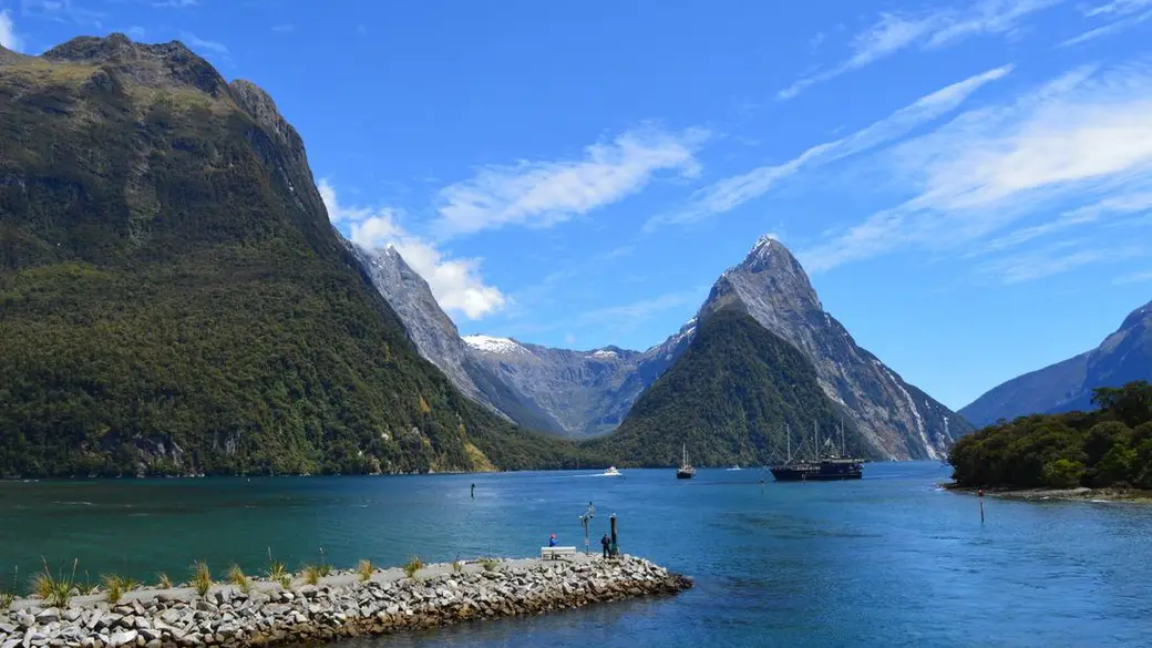
Milford Sound. Photo: Esther Grosscurt via Pexels. The most famous drive and cruise in New Zealand. Leave early, stop often, and let the rain do its thing.
Milford Sound/Piopiotahi is really a fiord, carved by glaciers. Mitre Peak rises 1,692 metres straight out of the water, and the walls carry on down to depths of up to 265 metres (DOC).
The 119 km Milford Road is the only road in. It runs up the Eglinton Valley, past Mirror Lakes and Lake Gunn, over The Divide and through the Homer Tunnel, then drops steeply to the fiord. It is sealed, but alpine, narrow in places and runs through avalanche terrain. DOC says to allow about 2.5 hours one way without stops, and the tunnel's traffic signals can add up to 20 minutes.
There is no fuel, no shop and very little phone coverage on the way. Traffic and car parks are busiest between 9.30 am and 1.30 pm (DOC), so an early start pays off. Do not be put off by rain: the cruises still run and the waterfalls are at their best when it pours.
How the day runs
- Morning7 am
Leave Te Anau with a full tank. Mirror Lakes are 56 km in, the Lake Gunn walk about 78 km.
- Midday
The Homer Tunnel and The Chasm, then park at Milford Sound. Allow up to 45 minutes to an hour to park and walk to the terminal.
- Afternoon
Your cruise (up to about 2 hours), then the drive back.
- Evening
Back in Te Anau for dinner. On night-closure nights, be past The Divide before 8 pm.
Stops and highlights5
Mirror Lakes. Small lakes that mirror the beech forest and mountains on a still day, with water birds and wetland plants, beside the road about 56 km from Te Anau (DOC).
- Time: 400 m return, 10 min
- Cost: Free
Lake Gunn Nature Walk. A flat loop through mossy beech forest to the lake shore, beside Cascade Creek campsite, about 78 km from Te Anau. Accessible toilets at the car park (DOC).
- Time: 1.4 km loop, 45 min
- Cost: Free
Homer Tunnel. A single-lane tunnel through the mountains, controlled by traffic lights. Wait at the lights and do not stop in the avalanche zones either side (DOC, NZTA).
The Chasm. A short forest walk to a river roaring through water-sculpted rock, about 109 km from Te Anau (DOC).
- Time: 400 m return, 20 min
- Cost: Free
Milford Sound cruise. Several operators sail from the visitor terminal. RealNZ's Classic Cruise and Southern Discoveries' Nature Cruise both start from $179 adult and run up to about 1 h 40 min to 2 h. Check in 20 minutes before departure.
- Cost: From $179 adult
- Parking: $10 an hour if you arrive before 3 pm, $5 an hour after; card only
Where to stay tonightTe Anau
- Back in Te Anau: Same as last night.
- DOC campsites: There are several bookable DOC campsites between Te Anau and The Divide, such as Henry Creek and Cascade Creek ($18 per adult). Staying here puts you ahead of the morning traffic.
Tip: In the avalanche zone, only stop at the signposted safe stops.
Road alert, as at November 2026: NZTA has overnight closures on the Milford Road between Hollyford Road and The Divide on Monday to Thursday nights, 8 pm to 5 am, from 9 November until about 11 December 2026, for river protection works. The road reopens at 10 pm to let queued traffic through. Plan to be back past The Divide before 8 pm on those nights, and check the NZTA Journey Planner before you set off.
Practical infoFuel, food, toilets, bookings, costs
- Fuel
- None between Te Anau and Milford Sound (DOC). Check you have enough for the round trip.
- Food and coffee
- None on the road. Pack lunch, snacks and water. Some cruises sell lunch add-ons.
- Toilets and dump stations
- Public toilets at Te Anau, Knobs Flat and Milford Sound (DOC). No dump stations along the road.
- Book ahead
- Book your cruise ahead in summer, with a departure that leaves time for the drive and parking. Check the cancellation terms in case the road closes.
- Best time of day
- Leave early to beat the 9.30 am to 1.30 pm peak (DOC). Cruises run in the rain, and the waterfalls are best then.
- Phone coverage
- Limited outside Te Anau. There is a card phone at Knobs Flat, an emergency satellite phone at the Homer Tunnel, and reception at Te Anau Downs, Totara Campsite, The Divide and Milford Sound (DOC).
- Watch out for
- Kea are endangered: do not feed them. No pets in the national park. If an earthquake feels long or strong at Milford Sound, move up and away from the water (DOC). In winter, chains may be needed.
- What today costs
- Parking: the average cruise visitor stays about 3 hours, so expect around $30 if you arrive before 3 pm. Cruises from $179 adult.
Got extra time?
- Camp on the Milford Road tonight instead of returning to Te Anau, and drive back in the morning.
Skip if
Skip the self-drive if you are tired or nervous on alpine roads. Southern Discoveries and RealNZ both sell coach and cruise packages from Te Anau and Queenstown.
Day 10: Te Anau to Twizel
Te Anau→Twizelvia Lindis Pass
- DistanceAbout 360 km
- Drive timeAbout 4.5 to 5 h
- OvernightTwizel
The longest day: from the wet south-west, through fruit and wine country, over the Lindis Pass into the dry, wide-open Mackenzie Basin.
This is the big driving day. You go back past Lake Wakatipu, through the Kawarau Gorge to Cromwell in Central Otago, then north over the Lindis Pass (971 metres, Te Ara) into the Mackenzie Country.
Watch the landscape change: green Fiordland farmland, then the rocky gorge, orchards and vineyards around Cromwell, then bare golden tussock hills over the pass. The roads are good, sealed state highways, but it is a long time behind the wheel, so share the driving and stop every couple of hours.
Twizel was founded in 1968 to house workers on the Upper Waitaki hydroelectric scheme (Twizel Promotions). Today it is a quiet, handy base for Aoraki/Mount Cook, about 50 minutes away (DOC), and often cheaper than the village at the mountain.
How the day runs
- Morning8 am
Leave Te Anau. Head back towards Kingston and the shore of Lake Wakatipu.
- Midday
Lunch and fuel in Cromwell.
- Afternoon
Over the Lindis Pass and on through Omarama to Twizel.
- Evening
An early, quiet night in Twizel.
Stops and highlights2
Cromwell. The natural halfway stop, with food and a 24/7 fuel stop on McNulty Road (Allied Petroleum).
Lindis Pass. A 971 metre pass on State Highway 8 between Central Otago and the Mackenzie Country, on the watershed between the Waitaki and Clutha rivers (Te Ara).
- Cost: Free
Where to stay tonightTwizel
- Holiday park: Twizel Holiday Park is a small, quiet park with powered sites, ensuite cabins and a self-contained cottage.
- Motels: Twizel has motels and holiday homes, and DOC notes it is 50 minutes from the Hooker Valley Track.
- Freedom camping: Self-contained vehicles only, where the council allows. See our freedom camping guide.
Tip: Rather split it? Stay a night in Wānaka or Cromwell and shorten day 11 instead.
Practical infoFuel, food, toilets, bookings, costs
- Fuel
- Te Anau before you leave, then Cromwell (24/7). Do not head over the Lindis Pass low on fuel.
- Food and coffee
- Cromwell for lunch. In Twizel, the Four Square supermarket is at 20 Market Place (Mackenzie Tourism).
- Book ahead
- Twizel and Aoraki/Mount Cook beds for the next two nights.
- Watch out for
- Fatigue is the real risk today. Swap drivers, take breaks and check NZTA for snow on the Lindis Pass outside summer.
- What today costs
- Mostly fuel. No paid stops.
Day 11: Aoraki/Mount Cook and the Hooker Valley
Twizel→Aoraki/Mount Cook
- DistanceAbout 130 km return
- Drive timeAbout 50 min each way (DOC)
- OvernightTwizel or Aoraki/Mount Cook Village
Swing bridges, a glacier lake and New Zealand's highest mountain, on one of the country's best easy walks.
Aoraki/Mount Cook is New Zealand's highest mountain. DOC describes the national park around it as a harsh land of ice and rock with virtually no forest, and the Tasman Glacier, New Zealand's largest and longest at 23 km, is visible from the highway as you drive in.
State Highway 80 runs along the shore of Lake Pūkaki to a very small alpine village at the end of the road (DOC). The drive is easy and spectacular. Snow can close it, mostly outside summer.
The Hooker Valley Track is the classic walk: mostly gentle, over swing bridges, to a glacier lake beneath the mountain. The weather decides everything, so check the forecast and go when the mountain is out.
How the day runs
- Morning7.30 am
Drive from Twizel and start the Hooker Valley Track early, before the car park fills.
- Midday
Lunch in the village, and a look around the DOC visitor centre.
- Afternoon
The short Tasman Glacier View walk, or Kea Point if you have energy left.
- Evening
Stay for the night sky, or drive back to Twizel.
Stops and highlights3
Hooker Valley Track. From White Horse Hill car park over swing bridges, including New Zealand's longest, to Hooker Lake at the foot of Aoraki/Mount Cook. Toilets about 15 minutes past the second swing bridge (DOC).
- Time: 10 km return, 3 h
- Cost: Free
- Parking: $2.50 per half hour or $25 a day; free under 20 min
Kea Point Track. A climb of 180 metres to a viewing deck facing Mount Sefton, the Mueller Glacier lake and Aoraki/Mount Cook (DOC).
- Time: 1 h return from the campground
- Cost: Free
Tasman Glacier View Track. Steps up to a viewpoint over the Tasman Glacier lake, with a side trip to the Blue Lakes, which are now green (DOC).
- Time: 1.5 km return, 30 min
- Cost: Free
- Parking: Free at Tasman Valley car park
Where to stay tonightTwizel or Aoraki/Mount Cook Village
- DOC campground: White Horse Hill Campground at the start of the Hooker Valley Track: $20 per adult a night, bookings required. The busiest period is Christmas to mid-February (DOC).
- Twizel: Twizel Holiday Park, or motels in Twizel, 50 minutes away.
Tip: Go early or late for softer light and fewer people.
Snow can close State Highway 80, so check conditions in winter and spring.
Practical infoFuel, food, toilets, bookings, costs
- Fuel
- The village has a petrol station (DOC), but fill up in Twizel.
- Food and coffee
- Limited café, restaurant and bar options in the village (DOC). Bring a picnic.
- Toilets and dump stations
- The village day shelter has toilets and coin-operated showers. White Horse Hill has accessible toilets and treated drinking water (DOC).
- Book ahead
- White Horse Hill Campground must be booked, and no spaces are kept for walk-ins.
- Best time of day
- Early morning. DOC warns White Horse Hill car park may have limited spaces from November to March between 10 am and 4 pm.
- Watch out for
- Stay out of the lakes and off the ice. Avalanches can occur in any season. No dogs, fires or drones. Take your rubbish with you: bins are limited (DOC).
- What today costs
- Parking up to $25 a day. The walks are free.
Got extra time?
- Stargazing: DOC says the national park is one of the best places in New Zealand to see the night sky, and suggests starting at the planetarium at the Hermitage.
Skip if
Skip the Hooker Valley in low cloud or strong wind and do the short Tasman Glacier View walk instead, or swap this day with tomorrow.
Day 12: On to Lake Tekapo
Twizel or Aoraki/Mount Cook→Lake Tekapo
- DistanceAbout 58 km (104 km from Aoraki/Mount Cook)
- Drive timeAbout 45 min from Twizel, 1.5 h from Aoraki/Mount Cook (DOC)
- OvernightLake Tekapo
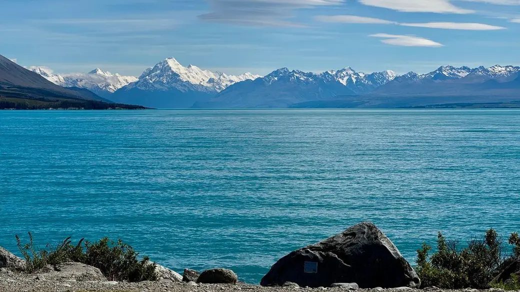
Lake Pūkaki. Photo: Thomas via Pexels. A short drive to a turquoise lake, hot pools in the afternoon and a huge dark-sky reserve.
Lake Tekapo/Takapō is 30 km long and 120 metres deep. Its milky turquoise colour comes from finely ground rock in the glacial meltwater that feeds it (DOC).
The town sits inside the Aoraki Mackenzie International Dark Sky Reserve, established in 2012 and covering 4,367 square kilometres, so tonight is your stargazing night. With so little driving, today is about slowing down: a lookout, a hill, hot pools and the sky.
How the day runs
- Morning
Drive along Lake Pūkaki with the mountain in your rear-view mirror, stopping at the lookouts.
- Midday
Up Mt John for the view and a coffee at the summit café.
- Afternoon
Soak at Tekapo Springs.
- Evening
A guided stargazing tour, or walk away from the streetlights after dark.
Stops and highlights3
Mt John. Drive to the top and walk the Summit Circuit, or walk up from Tekapo Springs on the Mt John Walkway. The summit is home to the University of Canterbury's Mt John Observatory and the Astro Café (DOC, Dark Sky Project).
- Time: Summit Circuit 30 to 45 min, or 8.9 km walkway loop, 3 h
- Cost: Free to walk
- Parking: Summit road $14 per vehicle, open 9 am to 4 pm
Tekapo Springs. Three hot pools with lake and mountain views at the base of Mt John. Until 30 November 2026 the pools open 11 am to 7 pm on weekdays and 10 am to 7 pm at weekends (Tekapo Springs).
Dark Sky Project. Guided stargazing, including the Summit Experience on Mt John (1 h 45 min) and the shorter Crater Experience (75 min). Book ahead and check the forecast.
Where to stay tonightLake Tekapo
- Tekapo: The town has a holiday park, motels, hotels and holiday homes. Book early for summer, when stargazing tours and beds sell out.
- Freedom camping: Self-contained vehicles only, where the council allows. See our freedom camping guide.
Tip: Book a stargazing tour, or just walk away from the streetlights after dark.
Practical infoFuel, food, toilets, bookings, costs
- Food and coffee
- Cafés and restaurants in Tekapo, plus the Astro Café on Mt John.
- Book ahead
- Stargazing tours and Tekapo Springs in summer.
- Best time of day
- Stargazing on a clear, moonless night. Tours start after dark, which is late in summer.
- Watch out for
- It gets cold at night even in summer, so bring warm layers for stargazing. Rubbish and recycling can go to the Resource Recovery Parks at Twizel, Tekapo and Fairlie (DOC).
- What today costs
- The walks are free. The Mt John summit road is $14 per vehicle. Hot pools and stargazing tours are the paid extras.
Got extra time?
- Lake Alexandrina: a quieter lake just west of Mt John (DOC).
Skip if
Skip a paid stargazing tour if the forecast is cloudy. You will see nothing.
Day 13: Lake Tekapo to Christchurch
Lake Tekapo→Christchurchvia Fairlie and Geraldine
- DistanceAbout 225 km
- Drive timeAbout 3 h
- OvernightChristchurch
A quiet lakeside church first thing, then down out of the high country and back across the plains.
Your last proper driving day. Start at the Church of the Good Shepherd on the lakeshore, then drop out of the high country through the small towns of Fairlie and Geraldine and cross the flat Canterbury Plains back to Christchurch. DOC puts Tekapo about 3 hours from Christchurch.
The roads are easy, but the long straight stretches across the plains are tiring after two weeks. Take breaks and watch your speed.
How the day runs
- MorningEarly
The Church of the Good Shepherd before the tour buses, then leave Tekapo.
- Midday
Lunch in Fairlie or Geraldine.
- Afternoon
Cross the Canterbury Plains to Christchurch. Clean out the van if you return it tomorrow.
- Evening
Dinner in the city.
Stops and highlights1
Church of the Good Shepherd. A small stone church on the lakeshore. The grounds are open during the day, but the church building has limited opening hours. No photography inside. Campervans and other long vehicles should park on the village side, just over the State Highway 8 bridge beside the Godley Hotel (Church of the Good Shepherd).
- Cost: $5 donation suggested; toilets $1
Where to stay tonightChristchurch
- Christchurch: The widest choice of the trip, from holiday parks to city hotels.
Practical infoFuel, food, toilets, bookings, costs
- Food and coffee
- Fairlie and Geraldine are the natural stops on the way.
- Best time of day
- The church early in the morning, before the crowds.
- What today costs
- A $5 donation at the church. Otherwise fuel and food.
Day 14: Spare day
Christchurch
- OvernightChristchurch
Do not skip this. Use it for a weather delay on the West Coast, a cancelled cruise, or a lazy day in Christchurch.
Keep this day free until the end. If rain closes a road on the West Coast or your Milford Sound cruise is cancelled, you shuffle the plan and still make your flight home.
If everything goes to plan, take a day trip to Akaroa on Banks Peninsula, an old volcanic peninsula south-east of the city. It is the site of the only attempted French settlement in New Zealand, from 1840, and the waters around it are a marine mammal sanctuary for rare Hector's dolphins (DOC).
Stops and highlights2
Akaroa. A harbour town with French street names and colonial buildings, 83 km from Christchurch. DOC says to allow 1.5 hours each way, as the road climbs and turns steeply.
- Time: About 1.5 h each way
By bus instead. The French Connection bus leaves daily at 9 am from outside the Canterbury Museum on Rolleston Avenue and returns to Christchurch at 5.45 pm (ChristchurchNZ).
Tip: If nothing goes wrong, explore the city or drive out to Akaroa on Banks Peninsula.
Practical infoFuel, food, toilets, bookings
- Book ahead
- Nothing until you know whether you need the day.
Trip complete
That's the loop. You legend.
14 days and about 2,000 km of driving, back where you started in Christchurch.
Full route in Google Maps (opens in a new tab)Back to the top of the itinerary
Drive times and distances
| Day | Route | Approx. distance | Approx. drive (no stops) |
|---|---|---|---|
| 1 | Christchurch to Hokitika via Arthur’s Pass | 250 km | 3.5 h |
| 2 | Hokitika Gorge return, then to Franz Josef | 200 km | 2.75 h |
| 3 | Franz Josef, Fox Glacier and Lake Matheson return | 60 km | 1 h |
| 4 | Franz Josef to Wānaka via Haast Pass | 285 km | 4 h |
| 5 | Wānaka (local) | Minimal | |
| 6 | Wānaka to Queenstown via Crown Range | 68 km | 1.25 h |
| 7 | Queenstown (optional Glenorchy return) | 0 to 92 km | 0 to 1.5 h |
| 8 | Queenstown to Te Anau | 171 km | 2.5 h |
| 9 | Te Anau to Milford Sound return | 238 km | 5 h (DOC) |
| 10 | Te Anau to Twizel | 360 km | 4.75 h |
| 11 | Twizel to Aoraki/Mount Cook return | 130 km | 1.75 h (DOC) |
| 12 | Twizel or Aoraki/Mount Cook to Lake Tekapo | 58 or 104 km | 0.75 or 1.5 h (DOC) |
| 13 | Lake Tekapo to Christchurch | 225 km | 3 h |
Campervan or car
Campervan if you want to wake up at lakes and save on accommodation. Only certified self-contained vans with a green warrant can freedom camp, so check the vehicle before you book. Our freedom camping guide explains the rules and fines. DOC campsites are a good fallback: basic sites are free, and standard sites cost $10 to $20 per adult per night.
Car plus motels if you want quicker driving on the Haast Pass and Milford Road, easier parking in Queenstown and a proper bed after long days.
What to book ahead
In summer and school holidays, book these as soon as your dates are firm:
- Your vehicle. Campervans especially sell out for December to February.
- Milford Sound cruise for day 9, with a time that allows for the 2.5 hour drive.
- Glacier heli-hike or scenic flight for day 3, if you want one.
- Accommodation in Queenstown, Te Anau, Aoraki/Mount Cook or Twizel, and Tekapo. These towns are small for the number of visitors.
- Stargazing tour in Tekapo.
Budget
Costs depend heavily on season and vehicle, so here are the verified prices we can stand behind rather than a made-up daily total:
| Item | Cost (as at November 2026) |
|---|---|
| DOC basic campsite | Free |
| DOC standard campsite | $10 to $20 per adult per night |
| DOC serviced campsite (unpowered) | $25 per adult per night |
| Skyline Gondola, Queenstown | $69 adult |
| Shotover Jet, Queenstown | $199 adult |
| Franz Josef glacier walk, Hokitika Gorge, Blue Pools, Hooker Valley | Free (some car parks charge) |
Fuel for about 2,000 km is a significant cost, and fuel in remote areas such as Haast and Aoraki/Mount Cook can cost more than in cities, so fill up in bigger towns when you can.
When to go
- November to April: long days, open passes, best chance of clear mountain views. December to February is the busiest and most expensive.
- Shoulder seasons (October, March to April): fewer people and lower prices. Note that Roys Peak is closed for lambing from 1 October to 10 November, and Isthmus Peak for fawning from 20 November to 20 December.
- May to September: stunning snow, short days, possible road closures, and chains may be required on the Milford Road (police can fine drivers $750 for passing chain signs without them).
Road safety on the route
- Keep left, and take extra care pulling back onto the road after stops.
- One-lane bridges are common on the West Coast and Haast Pass. Check the signs for who gives way.
- Do not stop in avalanche zones on the Milford Road except at the signposted safe stops at The Chasm and Monkey Creek.
- Watch the fatigue. The scenery is distracting and the roads are tiring. Swap drivers and stop every couple of hours.
- Check NZTA’s Journey Planner each morning for closures, especially on the Haast Pass, Milford Road and State Highway 80 to Aoraki/Mount Cook.
Starting from the North Island? Read Interislander vs Bluebridge for the Cook Strait crossing, then pick up this loop from Picton via the West Coast. Visiting from overseas? Sort your NZeTA first.
FAQ
Is 14 days enough for the South Island?
Should I drive the loop clockwise or anticlockwise?
Campervan or car for this route?
When is the best time to do this road trip?
How long is the drive from Te Anau to Milford Sound?
Do I need to book Milford Sound cruises in advance?
Sources
Last checked 11 November 2026
- Devils Punchbowl Walking Track · Department of Conservation
- Hokitika Gorge Walk · Department of Conservation
- Franz Josef Glacier/Kā Roimata o Hine Hukatere Walk · Department of Conservation
- Lake Matheson/Te Ara Kairaumati Walk · Department of Conservation
- Blue Pools Track · Department of Conservation
- Roys Peak Track · Department of Conservation
- Roys Peak Track (Lake Wānaka Tourism) · Lake Wānaka Tourism
See more sources (65)See fewer
- Journey tips for Piopiotahi Milford Sound · Department of Conservation
- SH94 Milford Road: important travel tips · NZ Transport Agency Waka Kotahi
- Southland traffic updates: SH94 night closures · NZTA Journey Planner
- Hooker Valley Track · Department of Conservation
- About the Aoraki Mackenzie International Dark Sky Reserve · Aoraki Mackenzie International Dark Sky Reserve
- Campsite categories: facilities and fees · Department of Conservation
- Kura Tāwhiti Access Track · Department of Conservation
- Arthur's Pass National Park · Department of Conservation
- Arthur's Pass Walking Track · Department of Conservation
- Klondyke Corner Campsite · Department of Conservation
- Avalanche Creek Shelter Campsite · Department of Conservation
- Ōtira Gorge and Arthur's Pass Road · Engineering New Zealand
- Hokitika · West Coast Tourism
- Glow Worm Dell Hokitika · Hokitika i-SITE
- Glacier Country · West Coast Tourism
- Westland Tai Poutini National Park campsites and services · Department of Conservation
- Peters Pool Walk · Department of Conservation
- Tatare Tunnels Walk · Department of Conservation
- Haast · West Coast Tourism
- Ship Creek Tauparikākā walks · Department of Conservation
- Short walks and activities in the Haast region (PDF) · Department of Conservation
- Thunder Creek Falls · Department of Conservation
- Fantail Falls Walk · Department of Conservation
- Awarua/Haast Visitor Centre · Department of Conservation
- Route guide: Lake Moeraki to Wānaka and Queenstown (PDF) · Wilderness Lodges
- Things to do in Haast · Waiatoto River Safari
- Cameron Flat Campsite · Department of Conservation
- Isthmus Peak Track · Department of Conservation
- Wānaka · Lake Wānaka Tourism
- Site locator (Wānaka and Cromwell fuel stops, PDF) · Allied Petroleum
- Otago places: Wānaka district (Crown Range, Lindis Pass) · Te Ara, the Encyclopedia of New Zealand
- Crown Range road summit · Te Ara, the Encyclopedia of New Zealand
- Arrowtown area · Department of Conservation
- Queenstown day walks and bike trails (PDF) · Department of Conservation
- Hampshire Holiday Parks Wānaka · Hampshire Holiday Parks
- Hampshire Holiday Parks Queenstown Lakeview · Hampshire Holiday Parks
- Fiordland National Park Visitor Centre · Department of Conservation
- Punanga Manu o Te Anau/Te Anau Bird Sanctuary · Department of Conservation
- Te Anau Glowworm Caves · RealNZ
- Te Anau Lakeview Holiday Park and Motels · Te Anau Lakeview Holiday Park
- Henry Creek Campsite · Department of Conservation
- Cascade Creek Campsite · Department of Conservation
- Milford Road/Milford Sound area · Department of Conservation
- Mirror Lakes Walk · Department of Conservation
- Lake Gunn Nature Walk · Department of Conservation
- The Chasm Walk · Department of Conservation
- Milford Sound travel tips and parking · Milford Sound Tourism
- Milford Sound Classic Cruise · RealNZ
- Milford Sound Nature Cruise · Southern Discoveries
- About Twizel · Twizel Promotions
- Twizel Four Square · Mackenzie Tourism
- Twizel Holiday Park · Twizel Holiday Park
- Aoraki/Mount Cook National Park · Department of Conservation
- White Horse Hill Campsite · Department of Conservation
- Kea Point Track · Department of Conservation
- Tasman Glacier View Track · Department of Conservation
- Lake Tekapo area · Department of Conservation
- Tekapo Mt John Walkway · Department of Conservation
- Astro Café and Mount John access road · Dark Sky Project
- Stargazing experiences · Dark Sky Project
- Tekapo Springs · Tekapo Springs
- Visit the Church of the Good Shepherd · Church of the Good Shepherd
- Banks Peninsula area · Department of Conservation
- Akaroa visitor information · ChristchurchNZ
- Route distances and drive times (OpenStreetMap routing, no stops) · OSRM / OpenStreetMap contributors