Queenstown to Franz Josef is about 354 km and 5 hours without stops by our routing estimate, over the Haast Pass (563 m). Do it in two days with a night in Haast, so you have time for the Blue Pools, the Haast valley waterfalls, Ship Creek and Lake Matheson. Fill up in Wānaka and Haast, and check the NZTA Journey Planner before you go: heavy rain can close the road.
On this page
Key facts
- Distance and time
- About 354 km, about 5 h without stops (estimate)
- Best overnight
- Haast, about 211 km from Queenstown
- Haast Pass
- 563 m, the lowest road crossing of the Southern Alps
- Fuel stops
- Wānaka, Makarora (limited), Haast Junction, Fox Glacier
- Top free stops
- Blue Pools, Thunder Creek Falls, Ship Creek, Lake Matheson
- Paid parking
- Franz Josef Glacier car park, up to $20 a day (DOC)
- Checked
- As at November 2026
The road from Queenstown to Franz Josef is one of the great drives in New Zealand. In a single day you go from dry, golden Central Otago, past two enormous blue lakes, over the Southern Alps and down into dripping rainforest on the West Coast. It is also long, remote and easy to underestimate, so a little planning goes a long way.
This guide gives honest drive times, the stops that are worth your time, the fuel gaps and a relaxed two-day plan with a night in Haast. Fees were checked on official sites as at November 2026. Drive times are routing estimates without stops, so add time for walks, photos and one-lane bridges.
Route overview
- Start and finish
- Queenstown to Franz Josef/Waiau
- Days
- 2 days
- Total driving
- About 365 km
- Longest day
- Day 1, Queenstown to Haast, about 211 km
- Best time
- October to April; any time with a road check
The route leaves Queenstown for Wānaka, over the Crown Range or via Cromwell, then follows State Highway 6 north past Lake Hāwea and Lake Wānaka to Makarora. It crosses the Haast Pass to Haast on the coast, then turns north up the West Coast to Fox Glacier and Franz Josef.
Day-by-day itinerary
Day 1: Queenstown to Haast over the Haast Pass
Queenstown→Haastvia Crown Range Road, Wānaka and State Highway 6
- DistanceAbout 211 km
- Drive timeAbout 3 h 20 min (estimate)
- OvernightHaast
Over the Crown Range to Wānaka, along two huge blue lakes, through beech forest to the Blue Pools and waterfalls, and down the Haast valley to the coast.
From Queenstown there are two ways to Wānaka. The Crown Range Road is the short way: it crosses a 1,076 m saddle, the highest point on a South Island main road (Te Ara). It is sealed but steep, with tight hairpins on the Queenstown side. The alternative is State Highway 6 via Cromwell, longer but gentler. Our routing estimates are about 69 km and 1 hour 25 minutes via the Crown Range, or about 114 km and 1 hour 35 minutes via Cromwell.
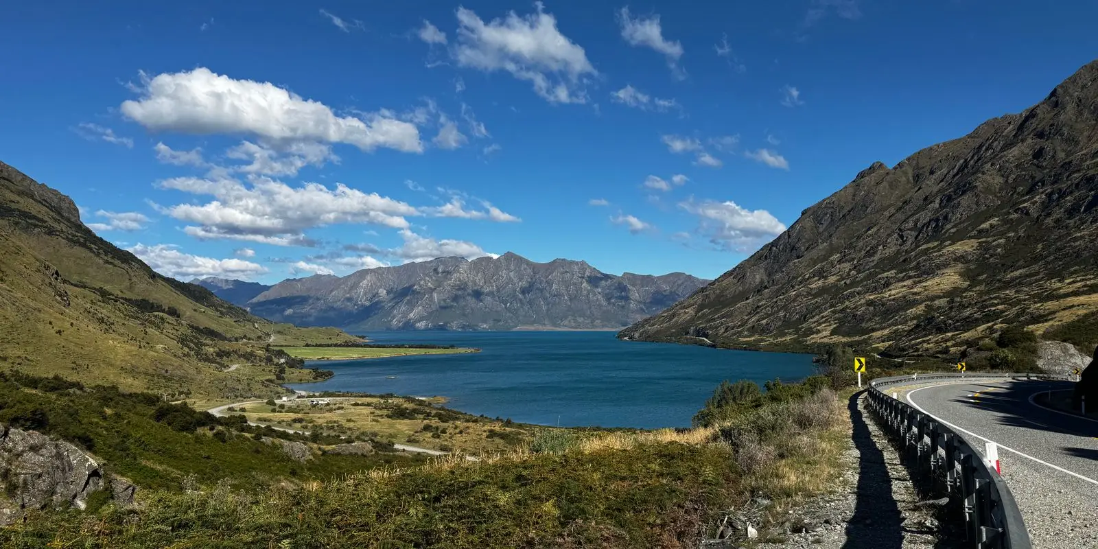
From Wānaka you follow Lake Hāwea and then Lake Wānaka north to Makarora, and climb gently through Mount Aspiring National Park to the Haast Pass. At 563 m it is the lowest of the three road crossings of the Southern Alps, but the descent through the Gates of Haast on the western side is steep and winding.
This is a remote road. Fuel stops are far apart and phone coverage comes and goes. Our routing estimate from Wānaka to Haast via the Blue Pools is about 142 km and 1 hour 55 minutes without stops, but the walks along the way can easily fill an afternoon.
How the day runs
- Morning8.30 am
Leave Queenstown over the Crown Range, stopping at the summit lookout. Coffee and fuel in Wānaka.
- Midday11.30 am
Along Lake Hāwea and Lake Wānaka to Makarora. Walk to the Blue Pools.
- Afternoon2 pm
Fantail Falls, Thunder Creek Falls and Roaring Billy Falls as you drop down the Haast valley.
- Evening4.30 pm
Arrive in Haast. Fill up for tomorrow and have dinner in the township.
Stops and highlights6
Crown Range summit. A lookout at the top of New Zealand's highest main road, with a plaque recording the 1859 crossing by William Rees and Nicholas von Tunzelmann (Te Ara).
- Cost: Free
Wānaka. A lake town at the southern end of Lake Wānaka, with Lake Hāwea next door (Lake Wānaka Tourism). Our things to do in Wānaka guide has more if you want to stay.
Blue Pools. Through silver beech forest to a swing bridge over the Makarora River and clear, glacier-fed pools. The car park is 10 km north of Makarora (DOC).
- Time: 3.2 km return, 1 h 30 min
- Cost: Free
- Parking: Free; very busy November to April
Fantail Falls. A short walk to a fan-shaped waterfall, 85 km from Wānaka (DOC).
- Time: 200 m return, 5 min
- Cost: Free
Thunder Creek Falls. A sealed track to a platform facing a 28 m waterfall, 50 km from Haast. The nearest toilets are at Pleasant Flat, 5 km towards Haast (DOC).
- Time: 200 m return, 5 min
- Cost: Free
Roaring Billy Falls. An easy fern-lined walk to a waterfall across the Haast River (DOC).
- Time: 1 km return, 25 min
- Cost: Free
Where to stay tonightHaast
- Haast: A small choice of motels, lodges and a holiday park. Book ahead in summer, because there is nowhere else nearby.
- DOC campsite: To break the drive earlier, Cameron Flat is across the road from the Blue Pools car park, $15 per adult, booking required (DOC).
- Freedom camping: Self-contained only, where the council or DOC allows it. Read our freedom camping guide first.
Tip: The Blue Pools get busy from late morning in summer. Leave Queenstown early, keep the Wānaka stop short, and you will beat most of the crowd.
Practical infoFuel, food, toilets, bookings, costs
- Fuel
- Queenstown or Wānaka, then Makarora, which has limited food and petrol (DOC), then Haast Junction, beside the DOC visitor centre. Fill up in Wānaka.
- Food and coffee
- Wānaka has the most choice. Makarora has a café. Haast township, 3 km south of the junction, has a café, a tavern and a grocery store.
- Toilets and dump stations
- Blue Pools car park, Pleasant Flat and the Haast visitor centre (DOC).
- Book ahead
- Haast beds, or Cameron Flat campsite.
- Best time of day
- Reach the Blue Pools before the car park fills. The pools are bluest when it has not rained for a while (DOC).
- Phone coverage
- Assume there is no coverage between Makarora and Haast. Download offline maps in Wānaka.
- Watch out for
- Sandflies at the Blue Pools and Roaring Billy. Heavy rain can cause slips, so check the NZTA Journey Planner before you leave. In a big campervan, take SH6 via Cromwell rather than the Crown Range.
- What today costs
- All the walks and parking are free. Costs are fuel, food and your bed.
Got extra time?
- Roys Peak: a long, steep ridge walk above Wānaka for fit walkers. DOC closes it from 1 October to 10 November each year for lambing.
Skip if
Snow or ice on the Crown Range? Take SH6 via Cromwell. Short on time? Skip Roaring Billy and keep Thunder Creek Falls and the Blue Pools.
Day 2: Haast to Franz Josef along the wild coast
Haast→Franz Josef/Waiauvia State Highway 6
- DistanceAbout 154 km, plus 8 km to the glacier car park and back
- Drive timeAbout 2 h 10 min (estimate)
- OvernightFranz Josef/Waiau
A swamp forest boardwalk, a cliff-top lookout, mirror reflections at Lake Matheson and an evening walk towards the Franz Josef Glacier.
North of Haast, State Highway 6 runs close to the Tasman Sea through rainforest, past lakes and empty beaches. This is the most remote coastal stretch of the West Coast, with few settlements and long gaps between services.
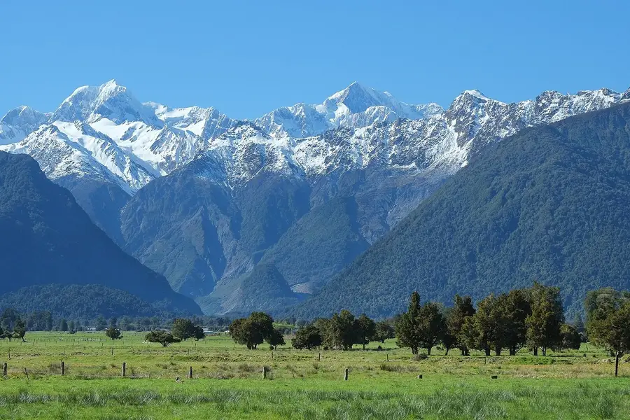
Your big stop is Lake Matheson/Te Ara Kairaumati, near Fox Glacier/Weheka, famous for mirror reflections of Aoraki/Mount Cook and Mount Tasman in its dark water. Then it is about 30 minutes on to Franz Josef/Waiau, a small glacier town on the edge of Westland Tai Poutini National Park.
Our routing estimate from Haast to Franz Josef via Ship Creek, Knights Point and Lake Matheson is about 154 km and 2 hours 10 minutes without stops. SH6 is sealed and mostly two lanes, with plenty of one-lane bridges.
How the day runs
- Morning9 am
Leave Haast. Ship Creek is 20 km north, then Knights Point lookout.
- Midday12 pm
Lunch in Fox Glacier/Weheka, then walk around Lake Matheson.
- Afternoon3 pm
Drive on to Franz Josef/Waiau and check in.
- Evening5 pm
Walk the glacier valley or Peters Pool in the evening light.
Stops and highlights4
Ship Creek Tauparikākā. Two short walks from one car park: a boardwalk through ancient kahikatea swamp forest, and a trail to a dune lake and the beach, with a viewing tower, toilets and picnic tables (DOC).
- Time: 800 m return (20 min) or 1 km loop (30 min)
- Cost: Free
Knights Point. A prominent lookout with wide views along the coast (West Coast Tourism).
- Cost: Free
Lake Matheson/Te Ara Kairaumati. The walk to Jetty Lookout suits wheelchairs, and the full circuit gives more viewpoints (DOC).
- Time: Jetty Lookout 2.4 km return (45 min), full circuit 4.4 km (1 h 30 min)
- Cost: Free
- Parking: Free; busy November to April
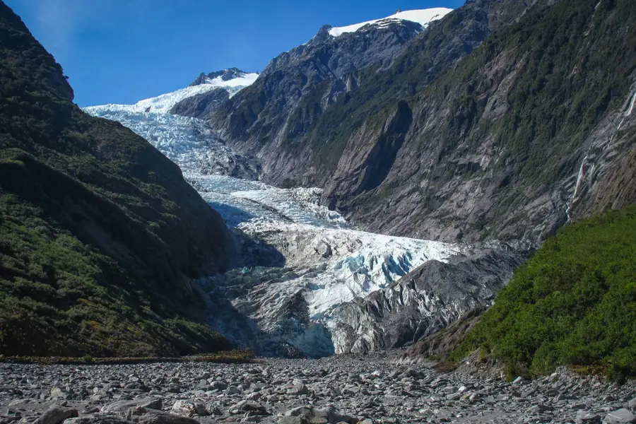
Franz Josef Glacier Walk. Follows the river valley to the viewpoint, about 4 km from town at the end of Glacier Access Road. Stay behind the barriers: river surges, rockfall and flash floods happen with little warning (DOC).
- Time: 1.7 km return, about 30 min
- Cost: Free
- Parking: DOC paid car park: $2.50 per half hour or $20 a day, card only
Where to stay tonightFranz Josef/Waiau
- Franz Josef/Waiau: Holiday parks, motels, hostels and hotels, all close to the main street. Book ahead in summer.
- Freedom camping: Self-contained only, where the council allows it. See our freedom camping guide.
Tip: Stay a second night in Franz Josef if you want a glacier flight. Flights only go when the weather allows, and a spare morning doubles your chances.
Practical infoFuel, food, toilets, bookings, costs
- Fuel
- Haast Junction before you leave, then Fox Glacier/Weheka and Franz Josef/Waiau (DOC).
- Food and coffee
- Fox Glacier for lunch, 5 minutes from Lake Matheson (DOC). Franz Josef has grocery stores and places to eat.
- Toilets and dump stations
- Ship Creek, Lake Matheson car park and the glacier car park (DOC).
- Book ahead
- A glacier heli-hike or scenic flight for tomorrow morning if you want one, and Franz Josef beds.
- Best time of day
- Lake Matheson is best on a fine, windless day, ideally at dawn or dusk (DOC).
- Phone coverage
- Unreliable at Lake Matheson and between towns.
- Watch out for
- Sandflies at Ship Creek and Lake Matheson. Rain can arrive at any time, so pack a raincoat.
- What today costs
- Glacier car park up to $20 a day (DOC, as at November 2026). The other stops are free.
Got extra time?
- Monro Beach: near Lake Moeraki, 30 km north of Haast, where you might see tawaki (Fiordland crested penguins), most likely from August to November (DOC).
Skip if
Arriving in Fox Glacier in heavy cloud? Skip the Lake Matheson walk today and do it at dawn tomorrow, when the air is calmer.
Trip complete
That's the loop. You legend.
2 days and about 365 km of driving, finishing in Franz Josef/Waiau.
Full route in Google Maps (opens in a new tab)Back to the top of the itinerary
Drive times and distances
Routing estimates without stops, rounded. Add 20 to 30 per cent for stops and campervans.
| Leg | Distance | Drive (estimate) |
|---|---|---|
| Queenstown to Wānaka via the Crown Range | About 69 km | About 1 h 25 min |
| Queenstown to Wānaka via Cromwell | About 114 km | About 1 h 35 min |
| Wānaka to Haast via Lake Hāwea, Makarora and the Blue Pools | About 142 km | About 1 h 55 min |
| Haast to Franz Josef via Ship Creek, Knights Point and Lake Matheson | About 154 km | About 2 h 10 min |
| Queenstown to Franz Josef, whole route | About 354 km | About 5 h |
By bus, InterCity’s Queenstown to Franz Josef service takes about 8 hours, stopping in Cromwell, Wānaka, Makarora and Haast.
The best stops on the way
| Stop | What it is | Time | Cost |
|---|---|---|---|
| Crown Range summit | Lookout on New Zealand’s highest main road | 10 min | Free |
| Blue Pools | Swing bridge and glacier-fed pools | 1 h 30 min | Free |
| Fantail Falls | Fan-shaped waterfall | 5 min | Free |
| Thunder Creek Falls | 28 m waterfall | 5 min | Free |
| Roaring Billy Falls | Forest walk to a waterfall | 25 min | Free |
| Ship Creek | Swamp forest boardwalk and dune lake | 20 to 30 min | Free |
| Knights Point | Coastal lookout | 10 min | Free |
| Lake Matheson | Mountain reflections | 45 min to 1 h 30 min | Free |
Insider tip: the Blue Pools are bluest after a dry spell, according to DOC. After heavy rain they can look cloudy, so if the weather has been wet, keep the visit short and spend more time at the waterfalls further on.
Road conditions on the Haast Pass
The Haast Pass road (State Highway 6) is sealed all the way, but it deserves respect:
- Weather and slips. The West Coast side is very wet, and heavy rain can bring slips and close the road. Check the NZTA Journey Planner on the morning you travel, and have a backup night planned.
- Steep and winding sections. The Gates of Haast, on the western side of the pass, are steep with tight bends. Use a low gear on the way down in a campervan.
- One-lane bridges. There are many between Haast and Franz Josef. Signs show who has priority; slow down and give way when it is not you.
- Fuel and phone gaps. Fill up in Wānaka and again at Haast Junction. Makarora has limited petrol (DOC), and coverage is patchy for long stretches.
- The Crown Range in winter. Te Ara notes that snow is not uncommon at the summit. If in doubt, take SH6 via Cromwell.
Where to stay
| Night | Base | Why |
|---|---|---|
| 1 | Haast | The natural halfway point; small, so book ahead |
| 1 (alternative) | Cameron Flat DOC campsite | Beside the Blue Pools, $15 per adult, bookings required |
| 1 (alternative) | Wānaka | If you leave Queenstown in the afternoon |
| 2 | Franz Josef/Waiau | Base for the glacier valley and heli-hikes |
Freedom camping is self-contained only, and only where it is allowed; our freedom camping rules cover the details. Our Franz Josef Glacier guide compares heli-hikes and the free walks.
Doing it in one day
It is possible. Leave Queenstown by 7.30 am, take the Cromwell route if you prefer an easier drive, and limit yourself to the Blue Pools, Thunder Creek Falls and Ship Creek. You will reach Franz Josef in the late afternoon. Do not try it in heavy rain or in a large campervan after a long flight.
FAQ
How long does it take to drive from Queenstown to Franz Josef?
Is the Haast Pass road dangerous?
Should I go via the Crown Range or Cromwell?
Can I take a bus from Queenstown to Franz Josef?
Where should I stop overnight between Queenstown and Franz Josef?
Sources
Last checked 11 November 2026
- Otago places: Wānaka district (Crown Range, Lindis Pass) · Te Ara, the Encyclopedia of New Zealand
- Crown Range road summit · Te Ara, the Encyclopedia of New Zealand
- Wānaka · Lake Wānaka Tourism
- Blue Pools Track · Department of Conservation
- Fantail Falls Walk · Department of Conservation
- Thunder Creek Falls · Department of Conservation
- Short walks and activities in the Haast region (PDF) · Department of Conservation
See more sources (14)See fewer
- Cameron Flat Campsite · Department of Conservation
- Awarua/Haast Visitor Centre · Department of Conservation
- Route guide: Lake Moeraki to Wānaka and Queenstown (PDF) · Wilderness Lodges
- Roys Peak Track · Department of Conservation
- Haast · West Coast Tourism
- Ship Creek Tauparikākā walks · Department of Conservation
- Glacier Country · West Coast Tourism
- Lake Matheson/Te Ara Kairaumati Walk · Department of Conservation
- Franz Josef Glacier/Kā Roimata o Hine Hukatere Walk · Department of Conservation
- Westland Tai Poutini National Park campsites and services · Department of Conservation
- Paid car parks · Department of Conservation
- Bus Queenstown to Franz Josef · InterCity
- NZTA Journey Planner: traffic and travel · NZ Transport Agency Waka Kotahi
- Route distances and drive times (OpenStreetMap routing, no stops) · Project OSRM